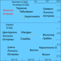
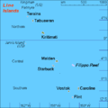
Category:Maps of the Line Islands
Jump to navigation
Jump to search
Subcategories
This category has the following 3 subcategories, out of 3 total.
M
P
Media in category "Maps of the Line Islands"
The following 31 files are in this category, out of 31 total.
-
20 Map of Kiritimati, Kiribati.jpg 694 × 632; 91 KB
-
21 Map of Tabuaeran, Kiribati.jpg 499 × 499; 99 KB
-
22 Map of Teeraina, Kiribati.jpg 1,024 × 743; 69 KB
-
Admiralty Chart No 2993 Plans in Christmas Island, Published 1963.jpg 11,227 × 8,261; 8.92 MB
-
CarolineIsland-CentralLeeward.JPG 196 × 469; 25 KB
-
CarolineIsland-Long.JPG 196 × 469; 25 KB
-
CarolineIsland-Nake.JPG 196 × 469; 25 KB
-
CarolineIsland-South-Nake.JPG 196 × 469; 25 KB
-
CarolineIsland-South.JPG 196 × 469; 25 KB
-
CarolineIsland-SouthLeeward.JPG 196 × 469; 25 KB
-
CarolineIsland-Windward-Islets.JPG 196 × 469; 25 KB
-
Flint Island Precision Map.jpg 1,252 × 877; 54 KB
-
KI Line islands mk.PNG 500 × 500; 31 KB
-
KI Line islands.PNG 500 × 500; 8 KB
-
Kiribati CIA map-DE.png 660 × 708; 18 KB
-
Kiribati Kiritimati location map.svg 1,367 × 1,118; 71 KB
-
Kiritimati island 77.jpg 1,468 × 1,114; 167 KB
-
Kiritimati Kiribati labels.svg 1,468 × 1,114; 41 KB
-
Kiritimati Kiribati mk.svg 1,468 × 1,114; 44 KB
-
Kiritimati Kiribati.svg 1,468 × 1,114; 32 KB
-
Line Islands location map (with names).svg 605 × 739; 1.96 MB
-
Line Islands location map.svg 605 × 739; 1.94 MB
-
Line Islands map.png 2,500 × 3,400; 153 KB
-
Location in Kiribati.png 1,407 × 636; 56 KB
-
LocationLineIslands.PNG 250 × 158; 4 KB
-
Northern Line Islands map.svg 1,439 × 1,459; 816 KB
-
Starbuck Island Map.jpg 1,240 × 904; 289 KB
-
Teraina, Kiribati.png 832 × 511; 312 KB
-
The seabed around Caroline Island and its nearest neighbours.svg 569 × 524; 1.74 MB


