Category:Maps of the Kola Peninsula
Jump to navigation
Jump to search
Subcategories
This category has the following 2 subcategories, out of 2 total.
E
M
- Maps of Kolsky Uyezd (8 F)
Media in category "Maps of the Kola Peninsula"
The following 22 files are in this category, out of 22 total.
-
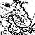
1714 - Laponie moscovite.jpg 275 × 275; 60 KB
-
221 of 'Half-Hours with the Early Explorers, etc' (11100873546).jpg 1,672 × 1,445; 628 KB
-
Acta Soc. pro Fauna et Flora Fennica (1889-1890) (16770844402).jpg 2,030 × 880; 375 KB
-
Acta Soc. pro Fauna et Flora Fennica (1889-1890) (16771916735).jpg 2,018 × 824; 340 KB
-
Askdsfsfde.png 1,102 × 600; 168 KB
-
Kol'skiy pivosrtiv XVI 01.jpg 1,679 × 1,249; 289 KB
-
Kola Peninsula map from 1660.jpg 881 × 936; 197 KB
-
Kola peninsula.png 1,140 × 860; 665 KB
-
Ksdp-kolapeninsula.jpg 1,413 × 1,030; 777 KB
-
Kuolan niemimaa.jpg 700 × 563; 117 KB
-
North Scandinavia 1544.jpg 1,020 × 820; 281 KB
-
Operational Navigation Chart C-2, 13th edition.jpg 9,040 × 6,591; 18.48 MB
-
Operational Navigation Chart C-3, 6th edition.jpg 9,106 × 6,653; 15.26 MB
-
Ptolemeus mapa Europe Kol's'kiy pivostriv.jpg 526 × 600; 75 KB
-
Tabularussiae.jpg 807 × 621; 304 KB
-
UBBasel Map 1600-1699 Kartenslg Mappe 248-48 Insula Kilduyn.tiff 4,791 × 2,667, 2 pages; 36.58 MB
-
White Sea map sl.png 1,000 × 930; 261 KB
-
White Sea map.png 1,000 × 930; 301 KB
-
Whiteseamap.jpg 1,478 × 1,267; 370 KB


