Category:Maps of the Kingdom of Iberia
Jump to navigation
Jump to search
Media in category "Maps of the Kingdom of Iberia"
The following 192 files are in this category, out of 192 total.
-
13 assyrian fathers' locations in mid-6th. c. Iberia.heb.svg 642 × 354; 1.03 MB
-
13 assyrian fathers' locations in mid-6th. c. Iberia.svg 642 × 354; 1.03 MB
-
1551 Venice Gastaldi-Descriptione de la Moscouia cropped.jpg 2,869 × 1,753; 1.35 MB
-
1842 map of Caucasus.jpg 852 × 679; 125 KB
-
Aghuank.jpg 1,512 × 944; 430 KB
-
Alexander den stores rike, Nordisk familjebok Caucasus.jpg 782 × 512; 159 KB
-
Ancient countries of Transcaucasia.jpg 2,029 × 1,198; 1.09 MB
-
Ancient kingdoms of Colchis and Iberia 793 BC.png 977 × 630; 1.45 MB
-
Ancientcolchisandiberia andersen.png 869 × 613; 29 KB
-
Antoine Philippe Houze . L'Empire des Perses. 1844 (B).jpg 1,285 × 979; 217 KB
-
Armenia, Colchis, Iberia, Albania, Etc.jpg 3,231 × 2,079; 2.09 MB
-
Armenian4thcenturies.gif 699 × 456; 49 KB
-
Arsacid (Arshakouni) Armenia, 63-299 A.D..png 700 × 473; 63 KB
-
Asia minor-Shepherd 1923 Georgia.jpg 807 × 515; 65 KB
-
Banduri and Lisle. Imperii Orientalis et Circumjacentium Regionum.C (Iberia, Lazica).jpg 1,048 × 1,513; 319 KB
-
Caucasian Iberia.jpg 788 × 733; 242 KB
-
Caucasus 250 AD map alt de.png 2,990 × 2,324; 3.53 MB
-
Caucasus 250 AD map alt de.svg 1,155 × 898; 4.46 MB
-
Caucasus 250 AD map alt es.svg 1,155 × 898; 1.03 MB
-
Caucasus 250 AD map alt pt.svg 1,155 × 898; 4.46 MB
-
Caucasus 250 AD map de.png 2,990 × 2,324; 3.53 MB
-
Caucasus 250 AD map de.svg 1,155 × 898; 4.45 MB
-
Caucasus 250 AD map hu.svg 1,155 × 898; 4.45 MB
-
Caucasus 290 BC map alt de.svg 1,155 × 898; 4.42 MB
-
Caucasus 290 BC map de alt.png 3,000 × 2,332; 3.51 MB
-
Caucasus 290 BC map de.svg 1,155 × 898; 4.42 MB
-
Caucasus 290 BC map es.svg 1,155 × 898; 3.83 MB
-
Caucasus 290 BC map hu.svg 1,155 × 898; 4.42 MB
-
Caucasus 290 BC map ka.svg 1,155 × 898; 4.42 MB
-
Caucasus 290 BC map pt.svg 1,155 × 898; 4.41 MB
-
Caucasus 290 BD map de.png 3,000 × 2,332; 3.53 MB
-
Caucasus 300 map alt de.png 2,990 × 2,324; 3.02 MB
-
Caucasus 300 map alt de.svg 1,155 × 898; 4.46 MB
-
Caucasus 300 map de.png 2,990 × 2,324; 3.51 MB
-
Caucasus 300 map de.svg 1,155 × 898; 4.44 MB
-
Caucasus 300 map es.svg 1,155 × 898; 3.36 MB
-
Caucasus 300 map pt.svg 1,155 × 898; 4.44 MB
-
Caucasus 385 AD map alt de.png 3,000 × 2,332; 3.52 MB
-
Caucasus 385 AD map alt de.svg 1,155 × 898; 4.44 MB
-
Caucasus 385 AD map de.png 3,000 × 2,332; 3.54 MB
-
Caucasus 385 AD map de.svg 1,155 × 898; 4.41 MB
-
Caucasus 565 map de alt.png 2,990 × 2,324; 3.13 MB
-
Caucasus 565 map de.png 2,990 × 2,324; 3.14 MB
-
Caucasus 565 map de.svg 1,155 × 898; 4.44 MB
-
Caucasus 565 map es.svg 1,155 × 898; 1.13 MB
-
Caucasus 565 map hu.svg 1,155 × 898; 4.41 MB
-
Caucasus 565n alt.svg 1,155 × 898; 4.44 MB
-
Caucasus 80 BC map alt de.png 2,990 × 2,324; 3.47 MB
-
Caucasus 80 BC map alt de.svg 1,155 × 898; 4.42 MB
-
Caucasus 80 BC map de.png 2,990 × 2,324; 3.5 MB
-
Caucasus 80 BC map de.svg 1,155 × 898; 4.42 MB
-
Caucasus 80 BC map hu.svg 1,155 × 898; 4.42 MB
-
Caucasus in 300 AD (Armenian - hy).png 1,127 × 833; 800 KB
-
Caucasus03333.jpg 778 × 600; 107 KB
-
Caucasus03-zh.jpg 874 × 645; 237 KB
-
Caucasus03-zh.png 874 × 645; 43 KB
-
Caucasus03.png 874 × 645; 40 KB
-
Caucasus03.jpg 874 × 645; 54 KB
-
Caucasus03 la.png 874 × 645; 44 KB
-
Caucasus03-es.svg 2,466 × 1,754; 227 KB
-
Caucasus03-sr.png 874 × 645; 41 KB
-
Caucasus Megrelian.jpg 874 × 645; 74 KB
-
Caucasus03 fr.png 874 × 645; 39 KB
-
Caucasus03RO.JPG 874 × 645; 56 KB
-
Armenia in 300 BC.png 850 × 607; 28 KB
-
Caucasus1stcentury-az.png 1,400 × 713; 85 KB
-
Caucasus1stcentury-nolegend-az.png 952 × 713; 59 KB
-
Cn Pompeius 66-64 BC Caucasus-es.svg 1,155 × 898; 3.91 MB
-
Cn Pompeius 66-64 BC Caucasus.png 1,780 × 1,108; 1.82 MB
-
Colchis and Iberia on Ptolemy Asia map.jpg 1,552 × 1,027; 345 KB
-
Colchis and Iberia, 1706.jpg 700 × 419; 165 KB
-
Colchis and Iberia, VI-III centuries B.C..jpg 1,280 × 992; 937 KB
-
Colchis, Yberia, Giorgia, Mengrelia and Albania.jpg 625 × 285; 47 KB
-
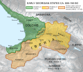
Early Georgian States Colchis And Iberia he.svg 792 × 696; 3.78 MB
-
Early Georgian States Colchis And Iberia ka.svg 792 × 696; 3.78 MB
-
Earlycaucasus655.jpg 1,180 × 791; 555 KB
-
Egnazio Danti - Middle east- Georgia, Armenia, Iraq, Western Iran - Google Art Project.jpg 6,062 × 8,866; 30.17 MB
-
Emirate of Armenia 750-885.png 700 × 456; 139 KB
-
European and Asiatic Sarmatia 1794.JPG 2,116 × 1,508; 1.92 MB
-
Fenner, Rest. Persis, Parthia, Armenia. 1835 (B).jpg 1,360 × 674; 249 KB
-
Fenner, Rest. Persis, Parthia, Armenia. 1835 (C).jpg 826 × 412; 102 KB
-
Fenner, Rest. Persis, Parthia, Armenia. 1835 (D).jpg 1,143 × 592; 199 KB
-
Fotothek df tg 0005111 Geographie ^ Karte.jpg 800 × 672; 302 KB
-
Gardiner814 (A).JPG 523 × 426; 88 KB
-
Ge iberia350.png 699 × 450; 39 KB
-
Georgia 1st 2nd centuries AD-ka.svg 1,333 × 1,047; 472 KB
-
Georgian States Colchis and Iberia (600-150BC)-en.svg 792 × 696; 4.01 MB
-
Georgian States Colchis and Iberia (600-150BC)-es.svg 792 × 696; 3.77 MB
-
Georgian States Colchis and Iberia (600-150BC)-pt.svg 792 × 696; 3.77 MB
-
Georgianiberia andersen565.JPG 1,166 × 817; 381 KB
-
Gerard de Jode version, Prime Partos Asia (Antwerp, 1577).A.jpg 7,900 × 4,333; 2.47 MB
-
Gerard Mercator. Tabula Asiae III (Georgia).jpg 857 × 428; 161 KB
-
Heinrich Kiepert. Asia citerior.Colchis.Iberia.jpg 1,464 × 509; 187 KB
-
Hiberia on Tabula Peutingeriana.jpg 647 × 301; 43 KB
-
Iberia in 150-200-fr.svg 1,155 × 898; 310 KB
-
Iberia ka.png 1,155 × 898; 1.13 MB
-
Iberia map ru.png 1,155 × 898; 1.07 MB
-
Iberia, Giorgiana, Mengrelia, Colchide.jpg 1,922 × 1,371; 875 KB
-
Iberia-en.svg 3,404 × 2,432; 938 KB
-
Iberia-es.svg 3,404 × 2,432; 617 KB
-
Iberia-ka.svg 3,404 × 2,432; 1.1 MB
-
Iberia-pt.svg 3,404 × 2,432; 938 KB
-
Iberia.svg 3,404 × 2,432; 333 KB
-
Iberian-principality-690.jpg 2,304 × 2,048; 542 KB
-
Imperio Armenio.gif 1,000 × 564; 33 KB
-
Map of Colchis, Iberia, Albania, and the neighbouring countries ca 1770.jpg 1,016 × 760; 194 KB
-
Map of Kingdom of Iberia, III c. BC-es.svg 930 × 633; 1.11 MB
-
Map of Kingdom of Iberia, III c. BC-he.svg 930 × 633; 1.11 MB
-
Map of Kingdom of Iberia, III c. BC.svg 930 × 633; 1.11 MB
-
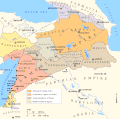
Map of Persian Armenia and its surroundings.svg 512 × 327; 57 KB
-
Map of the Armenian Empire of Tigranes (English).svg 512 × 506; 61 KB
-
Maps of the Armenian Empire of Tigranes-es.svg 1,975 × 1,958; 640 KB
-
Maps of the Armenian Empire of Tigranes-he.svg 512 × 506; 38 KB
-
Maps of the Armenian Empire of Tigranes-pt.svg 512 × 506; 50 KB
-
Maps of the Armenian Empire of Tigranes.gif 673 × 669; 56 KB
-
Persian Armenia-es.svg 1,030 × 656; 1.27 MB
-
Persian Armenia-fr.svg 512 × 327; 41 KB
-
Persian Armenia-hu.svg 675 × 431; 83 KB
-
Persian Armenia-pt.svg 512 × 327; 46 KB
-
Persian Armenia.gif 698 × 455; 53 KB
-
Proto-Kartvelian tribes 2nd millenium BC-ka.svg 1,002 × 646; 1.02 MB
-
Roman East 50 CE Commagene highlighted-en.svg 2,717 × 1,595; 854 KB
-
Roman East 50 CE Commagene highlighted-zh.svg 3,396 × 1,993; 2.7 MB
-
Roman East 50-ang.svg 2,717 × 1,595; 822 KB
-
Roman East 50-en.svg 2,717 × 1,595; 848 KB
-
Roman East 50-es.svg 2,717 × 1,595; 3.6 MB
-
Roman East 50-fi.svg 2,717 × 1,595; 854 KB
-
Roman East 50-he.svg 2,717 × 1,595; 854 KB
-
Roman East 50-hu.svg 2,717 × 1,595; 858 KB
-
Roman East 50-it.svg 2,717 × 1,595; 857 KB
-
Roman East 50-pt.svg 2,717 × 1,595; 851 KB
-
Roman East 50-zh.svg 3,396 × 1,993; 2.68 MB
-
Roman-Parthian War 58-60-fi.svg 2,717 × 1,595; 552 KB
-
Roman-Parthian War 58-60-it.svg 2,750 × 1,790; 469 KB
-
Roman-Parthian War 58-60-vi.svg 512 × 300; 207 KB
-
Roman-Parthian War 58-60-zh.svg 4,188 × 2,531; 495 KB
-
Roman-Parthian War 58-60.es.svg 3,350 × 2,025; 558 KB
-
Roman-Parthian War 58-60.pt.svg 3,350 × 2,025; 556 KB
-
Roman-Parthian War 58-60.svg 3,350 × 2,025; 1.17 MB
-
Roman-Parthian War 61-63.es.svg 3,350 × 2,025; 454 KB
-
Roman-Parthian War 61-63.pt.svg 3,350 × 2,025; 458 KB
-
Roman-Persian Frontier in Late Antiquity-ar.svg 2,727 × 1,804; 1.72 MB
-
Roman-Persian Frontier in Late Antiquity-es.svg 2,727 × 1,804; 4.55 MB
-
Roman-Persian Frontier in Late Antiquity-fr.svg 2,727 × 1,804; 849 KB
-
Roman-Persian Frontier in Late Antiquity-hu.svg 2,727 × 1,804; 3.2 MB
-
Roman-Persian Frontier in Late Antiquity-pt.svg 2,727 × 1,804; 830 KB
-
Roman-Persian Frontier in Late Antiquity-ru.svg 2,718 × 1,743; 1.61 MB
-
Roman-Persian Frontier in Late Antiquity-zh.svg 2,710 × 1,740; 1.58 MB
-
Roman-Persian Frontier in Late Antiquity.svg 2,710 × 1,740; 2 MB
-
RomanPowerAsiaMinor90BCE.JPG 762 × 420; 119 KB
-
Sanson, Nicolas. Armenia maior, Colchis, Iberia, Albania. 1655.jpg 2,731 × 2,165; 1.37 MB
-
Sebastian Münster. Map of Colchis and Caucasian Iberia. 1544.GIF 1,237 × 834; 138 KB
-
Shepherd-c-018-019 cropped Caucasus.JPG 727 × 570; 169 KB
-
Shepherd-c-018-019 cropped Middle East.JPG 1,142 × 914; 350 KB
-
Shepherd-c-020 cropped Armenia.jpg 451 × 423; 90 KB
-
TabulaPeutingeriana. Colchis&Iberia.jpg 2,753 × 397; 371 KB
-
The Ambassadors (Holbein), Iberia and Georgia detail.jpg 328 × 199; 22 KB
-
Thiberia on Hereford Mappa Mundi.jpg 688 × 386; 43 KB
-
Transcaucasia 2nd BC-ar.png 982 × 772; 445 KB
-
Transcaucasia 2nd BC.jpg 982 × 772; 232 KB
-
Various Caucasian peoples 2nd millenium BC.svg 1,002 × 646; 1.02 MB
-
Whiston1736.jpg 674 × 800; 85 KB
-
Yervanduni Armenia, IV-II BC.gif 700 × 457; 58 KB
-
Второй поход Помпея против албан.jpg 621 × 338; 61 KB
-
Первый поход Помпея против албан.jpg 618 × 335; 59 KB
-
Հայաստանը վաղ միջնադարում.svg 2,710 × 1,740; 830 KB
-
Հռոմեա-պարթևական պատերազմ, 58-60.svg 3,350 × 2,025; 513 KB


