Category:Maps of the Kingdom of Dalmatia
Jump to navigation
Jump to search
Media in category "Maps of the Kingdom of Dalmatia"
The following 16 files are in this category, out of 16 total.
-
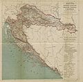
(1879) MAP OF CROATIA, SLAVONIA, DALMATIA & 'MILITÄRGRENZE' of AUSTRIAN EMPIRE.jpg 5,109 × 5,033; 10.02 MB
-
Dalmatia1911.png 460 × 363; 438 KB
-
Dalmatien Donaumonarchie.png 674 × 510; 24 KB
-
Donaumonarchie Dalmatië.png 519 × 393; 12 KB
-
Empire d'Autriche 1914 Dalmatie.png 3,507 × 2,480; 3.82 MB
-
Kingdom of Dalmatia-1868.png 542 × 502; 35 KB
-
Kingdom of Dalmatia.jpg 625 × 530; 355 KB
-
Map of the Kingdom of Croatia (1848).png 542 × 502; 39 KB
-
Map of the Kingdom of Croatia (1868).png 542 × 502; 40 KB
-
Map of the Kingdom of Croatia-Slavonia (1885).png 542 × 502; 31 KB
-
Religioni dalmazia.png 988 × 492; 888 KB
-
Triune Kingdom of Croatia (1868-1918)-de.svg 512 × 382; 189 KB
-
Triune Kingdom of Croatia (1868-1918)-es.svg 2,162 × 1,614; 385 KB
-
Triune Kingdom of Croatia (1868-1918)-hu.svg 2,162 × 1,614; 257 KB
-
Triune Kingdom of Croatia (1868-1918).png 826 × 798; 113 KB


