Category:Maps of the Kenai Peninsula
Jump to navigation
Jump to search
Subcategories
This category has only the following subcategory.
M
Media in category "Maps of the Kenai Peninsula"
The following 11 files are in this category, out of 11 total.
-
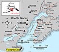
Fourpeaked-map1.jpg 800 × 701; 82 KB
-
Kenay peninsula.png 940 × 534; 921 KB
-
Map of Alaska Volcanoes 1.gif 375 × 395; 117 KB
-
Map of Alaska, kenai peninsula.gif 500 × 500; 72 KB
-
Map Prince-William-Sound AK.jpg 300 × 226; 40 KB
-
Matanuska-Susitna Valley.jpg 300 × 280; 50 KB
-
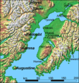
Monti Kenai ENBLA.jpg 594 × 551; 130 KB
-
Wpdms shdrlfi020l cook inlet with arms.jpg 300 × 226; 41 KB
-
Wpdms shdrlfi020l matanuska river.jpg 300 × 280; 49 KB


