Category:Maps of the Juan Fernández Islands
Jump to navigation
Jump to search
Subcategories
This category has the following 2 subcategories, out of 2 total.
Media in category "Maps of the Juan Fernández Islands"
The following 27 files are in this category, out of 27 total.
-
"Pl. XXVI". Plan de l'Isle de Juan Fernandez (21084029969).jpg 3,887 × 2,939; 6.23 MB
-
A Plan of Juan Fernandes island in the south sea... two leagues - btv1b8491742m.jpg 8,144 × 4,029; 4.07 MB
-
Comuna de Juan Fernández.svg 481 × 596; 100 KB
-
Comuna Juan Fernández.png 400 × 600; 51 KB
-
Descripción de la Ysla Grande de Juan Fernández.JPG 3,056 × 2,234; 1,021 KB
-
EVS map Robinson Crusoe Island.jpg 1,276 × 885; 351 KB
-
Flag map of Juan Fernández Islands (1574-1818).svg 1,418 × 1,000; 64 KB
-
Flag map Robinson Crusoe & Santa Clara Islands, Chile.svg 1,418 × 1,000; 66 KB
-
Flag map Robinson Crusoe & Santa Clara Islands, Juan Fernández Islands.svg 1,418 × 1,000; 236 KB
-
Isla mas Afuera Juan Fernandez (Chili).jpg 316 × 174; 17 KB
-
Isla mas Atierra Juan Fernandez (Chili).jpg 419 × 304; 32 KB
-
Juan fernandez 1927.jpg 1,978 × 717; 170 KB
-
Juan fernandez masafuera.jpg 640 × 767; 78 KB
-
Locator map of the Republic of Chile.svg 512 × 778; 1.2 MB
-
Map-juan-fernandez-island-1753.jpg 3,500 × 2,476; 9.66 MB
-
Maqueta del archipiélago Juan Fernández (20200826 111100).jpg 4,012 × 2,232; 5.85 MB
-
N° 53 - Isla Juán Fernandez.png 1,600 × 1,205; 1.34 MB
-
Plano de las Islas Juan Fernandez del Reino de Chile en 1744 - AHG.jpg 9,330 × 6,938; 6.63 MB
-
Rob-cru.png 724 × 562; 311 KB
-
Robinson Crusoe Island location map.svg 400 × 277; 38 KB
-
Robinson Crusoe.JPG 410 × 167; 13 KB
-
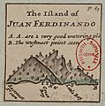
The Island of Juan Ferdinando - (Hermann Moll) - btv1b8596521j.jpg 775 × 784; 120 KB
-
Underwater Layout - Flickr - The Official CTBTO Photostream.jpg 1,850 × 2,271; 1.18 MB


