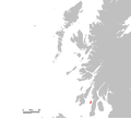
Category:Maps of the Isle of Gigha
Jump to navigation
Jump to search
English: Maps of the Isle of Gigha, Argyll and Bute, Scotland.
Wikimedia category | |||||
| Upload media | |||||
| Instance of | |||||
|---|---|---|---|---|---|
| Category combines topics | |||||
| Isle of Gigha | |||||
island off the west coast of Kintyre, Argyll and Bute, Scotland, UK | |||||
| Instance of | |||||
| Part of | |||||
| Location |
| ||||
| Located in or next to body of water | |||||
| Owned by |
| ||||
| Width |
| ||||
| Length |
| ||||
| Population |
| ||||
| Area |
| ||||
 | |||||
Media in category "Maps of the Isle of Gigha"
The following 13 files are in this category, out of 13 total.
-
Admiralty Chart No 2159 Firth of Clyde, Published 1869.jpg 11,193 × 19,484; 22.08 MB
-
Gigha in Southern Argyll.svg 885 × 655; 3.56 MB
-
Gigha in the Argyllshire Hebrides.svg 981 × 1,241; 3.43 MB
-
Gigha Inner Hebrides.svg 1,161 × 2,563; 4.35 MB
-
Giogha.PNG 648 × 584; 10 KB
-
Ila Insula by Blaeu 1665.jpg 9,090 × 6,705; 8.48 MB
-
Journal of the Royal Society of Antiquaries of Ireland (1899) (14785036095).jpg 1,316 × 2,656; 307 KB
-
Ordnance Survey One-Inch Sheet 58 Knapdale, Published 1956 2.jpg 8,597 × 10,871; 16.43 MB
-
Ordnance Survey One-Inch Sheet 58 Knapdale, Published 1956.jpg 8,229 × 9,867; 9.03 MB
-
Ordnance Survey One-Inch Sheet 70 Sound of Jura, Published 1926.jpg 8,762 × 13,998; 12.83 MB
-
Ordnance Survey One-Inch Sheet 76 Kintyre, Published 1925.jpg 10,558 × 15,392; 14.21 MB
-
Read Page022 Islay Colonsay Jura.jpg 1,356 × 1,389; 185 KB
-
UK Gigha.PNG 648 × 584; 20 KB


