Category:Maps of the Isar watercourse system
Jump to navigation
Jump to search
Wikimedia category | |||||
| Upload media | |||||
| Instance of | |||||
|---|---|---|---|---|---|
| Category combines topics | |||||
| Isar | |||||
river in Tyrol, Austria and Bavaria, Germany | |||||
| Spoken text audio | |||||
| Instance of | |||||
| Location | |||||
| Length |
| ||||
| Mouth of the watercourse | |||||
| Drainage basin | |||||
| Tributary |
| ||||
| Lake on watercourse | |||||
 | |||||
Deutsch: Karten des Gewässersystems der Isar
English: Maps of the Isar watercourse system
Media in category "Maps of the Isar watercourse system"
The following 39 files are in this category, out of 39 total.
-
Verlaufskarte Isar (de).png 1,709 × 1,788; 4.43 MB
-
Aubach Pilsensee.png 841 × 843; 141 KB
-
Auenbach.png 2,254 × 1,537; 866 KB
-
Dingolfing cropped from Dingolfing Isartal 1718.jpg 1,177 × 2,379; 1.95 MB
-
Dingolfing Isartal 1718.png 2,892 × 2,113; 15.18 MB
-
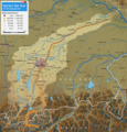
Einzugsbereich Isar Teilausschnitt.png 699 × 818; 46 KB
-
Fischbach Ammersee.png 837 × 835; 139 KB
-
Fluss lage isar Latein.PNG 1,212 × 1,060; 407 KB
-
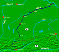
Fluss lage isar.PNG 1,212 × 1,060; 482 KB
-
Flusssystem Ammer Amper.png 834 × 1,074; 77 KB
-
Gewaesser in freising.png 2,976 × 1,543; 2.5 MB
-
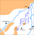
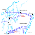
Gewaesser in Muenchen.png 1,280 × 960; 262 KB
-
Goldach.png 3,076 × 4,672; 16.35 MB
-
Groebenbach Catchment.png 660 × 692; 31 KB
-
Hammerbach (Isar).png 2,254 × 2,178; 1.2 MB
-
Herrschinger Moos (Karte).jpg 371 × 444; 88 KB
-
Höfen cropped from Dingolfing Isartal 1718.jpg 1,065 × 1,778; 1.32 MB
-
Inninger Bach Catchment.png 955 × 803; 144 KB
-
Isar bg 2.png 1,709 × 1,788; 4.46 MB
-
Isarkarta.PNG 686 × 600; 247 KB
-
Isartal bei Dingolfing Adrian von Riedl 1802.jpg 6,395 × 4,100; 5.31 MB
-
Kankerbach Catchment.png 959 × 422; 128 KB
-
Karte Angerbach Marzling.png 2,984 × 1,955; 2.19 MB
-
Karte Loisach-Isar-Kanal.png 1,967 × 3,233; 1.64 MB
-
Karte Speichersee Ismaning.png 1,849 × 568; 212 KB
-
Kienbach.png 504 × 825; 88 KB
-
Klötzlmühlbach.png 7,573 × 3,398; 3.96 MB
-
Lage fluss inn.png 2,046 × 1,759; 3.95 MB
-
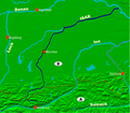
Lage fluss isar.PNG 1,212 × 1,060; 480 KB
-
Landau Isar 1798.jpg 6,738 × 5,532; 3.72 MB
-
Loisach Isar catchment.png 1,685 × 1,945; 4 MB
-
Moosach (Isar).png 6,146 × 4,921; 6.59 MB
-
Muehlthal 0.jpg 560 × 841; 66 KB
-
Mühlbach (Amper).png 7,465 × 9,098; 6.26 MB
-
Neidernach Catchment.png 808 × 936; 98 KB
-
Nordmünchner Kanalsystem.png 934 × 928; 89 KB
-
Osterseen im Flusssystem.png 834 × 1,074; 208 KB
-
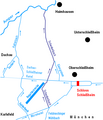
Schwebelbach.png 656 × 764; 62 KB
-
St. Michaelstein-Historische Karte.jpg 751 × 906; 738 KB


