Category:Maps of the Iroquois
Jump to navigation
Jump to search
Media in category "Maps of the Iroquois"
The following 52 files are in this category, out of 52 total.
-
5 Irokesen Nationen 1650.gif 695 × 600; 32 KB
-
5 plemion irokezkich 1650.png 695 × 600; 43 KB
-
5NationsCession.jpg 450 × 443; 44 KB
-
5NationsExpansion.jpg 441 × 443; 45 KB
-
Carte pour suivre la campagne de d'Iberville dans la baie d'Hudson en 1697.jpg 2,171 × 1,633; 2.79 MB
-
Cat-Nation.png 497 × 310; 17 KB
-
Codex canadensis, deuxieme de couverture.jpg 2,293 × 1,749; 1.54 MB
-
Early Localization Native Americans NY - Red-Green Coloring.svg 936 × 766; 291 KB
-
Early Localization Native Americans NY-es.svg 936 × 768; 299 KB
-
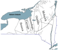
Early Localization Native Americans NY.jpg 499 × 438; 257 KB
-
Early Localization Native Americans NY.svg 936 × 768; 291 KB
-
Erie-Cattaraugus Reservation.png 461 × 599; 58 KB
-
Erie-Territorium um 1630.png 1,200 × 902; 1.37 MB
-
Erie-Tonawanda Reservation.png 461 × 599; 58 KB
-
Frontier of NY in Revolution2.png 1,000 × 796; 780 KB
-
Guy Johnson, Map of the Country of the VI Nations, 1771 (cropped).jpg 8,272 × 5,479; 36.57 MB
-
Haudenosaunee Territory.png 2,000 × 2,000; 366 KB
-
Irokesen (5 Nationen um1650).png 1,134 × 730; 1.07 MB
-
Iroquoi.png 350 × 291; 19 KB
-
Iroquoi.svg 720 × 653; 20 KB
-
Iroquoiens St Laurent.png 336 × 282; 26 KB
-
Iroquoiens St Laurent.svg 526 × 437; 475 KB
-
Iroquoiens-St-Laurent.PNG 336 × 282; 23 KB
-
Iroquois 5 Nation Map c1650.png 950 × 820; 245 KB
-
Iroquois 5 Nations 1650.gif 1,013 × 906; 93 KB
-
Iroquois 6 Nations map c1720.png 588 × 427; 114 KB
-
Iroquois land 1710-1720.jpg 1,381 × 1,130; 2.11 MB
-
Iroquois Settlement on the north shore of Lake Ontario 1665-1701.tiff 1,120 × 645; 299 KB
-
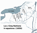
Les Cinq Nations iroquoises (1650).svg 950 × 850; 384 KB
-
Map from Indian land cessions in the United States by Charles C. Royce 48.jpg 3,283 × 2,141; 2.18 MB
-
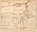
Map of Iroquois Five Nations and Mission Sites 1656-1684 by John S. Clark 1879.png 5,711 × 4,926; 13.35 MB
-
Map of Oneida Reservation - NARA - 76028691.jpg 8,224 × 11,719; 8.12 MB
-
Map of Oneida Reservation - NARA - 76028693.jpg 8,384 × 11,493; 6.14 MB
-
Nanfan-es.svg 512 × 396; 1.86 MB
-
Nanfan.jpg 994 × 768; 543 KB
-
Nanfan.svg 512 × 396; 1.48 MB
-
Oklahoma Tribal Statistical Area.svg 828 × 400; 1.49 MB
-
Rivière de Cataracoui ou des Iroquois.jpg 643 × 435; 99 KB
-
Seneca Nation territory 1794.tif 2,525 × 1,849; 77 KB
-
Tionontati.png 996 × 694; 281 KB
-
Tribal nations in NW New York Province.jpg 1,477 × 1,037; 215 KB
-
Tuscarora Reservation.jpg 2,988 × 5,312; 4.83 MB
-
Upper Canada and the Iroquois Confederacy.jpg 1,050 × 1,531; 303 KB
-
Wenro Territory ca1630 map-en.svg 2,300 × 1,700; 9.76 MB
-
Wenro Territory ca1630 map-es.svg 2,300 × 1,700; 10.48 MB
-
Wenro-Territorium um 1630 (cropped).png 1,095 × 730; 961 KB
-
Wenro-Territorium um 1630.png 1,134 × 730; 1.06 MB
-
WenroSVG.svg 936 × 768; 772 KB


