Category:Maps of the Inn watercourse system
Jump to navigation
Jump to search
Subcategories
This category has only the following subcategory.
Media in category "Maps of the Inn watercourse system"
The following 22 files are in this category, out of 22 total.
-
 Auerbach.png 3,708 × 1,755; 264 KB
-
 Glacier de l'Inn.svg 647 × 497; 84 KB
-
 Inn river.jpg 347 × 186; 9 KB
-
 Karte Bezirk Landeck.png 1,050 × 1,017; 235 KB
-
 Inn river Route.svg 1,256 × 700; 182 KB
-
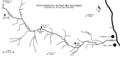
 Inn-skizo.png 525 × 317; 5 KB
-
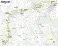 Karte Alzkanal.png 2,004 × 1,601; 1.32 MB
-
 Kraftwerk Kirchbichl.png 2,206 × 2,174; 1.43 MB
-
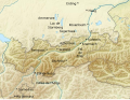
 Lage fluss inn.png 2,046 × 1,759; 3.95 MB
-
 Leitzachwerke.png 1,460 × 1,979; 1.57 MB
-
 Linke Nebenflüsse der Sill.png 844 × 704; 1.03 MB
-
 OetztalerAche Inn catchment.png 1,736 × 2,596; 7.65 MB
-
 Passau Altstadt.svg 769 × 525; 34 KB
-
 Passau Hacklberg.svg 1,000 × 552; 78 KB
-
 Passau Haidenhof.svg 1,000 × 552; 78 KB
-
 Passau Stadtteile.svg 1,000 × 552; 77 KB
-
 Rechte Nebenflüsse der Sill.png 813 × 683; 946 KB
-
 Sanna Inn catchment.png 1,600 × 1,621; 4.39 MB
-
 Sill Inn catchment.png 1,200 × 1,154; 2.47 MB
-
 Verlauf der Sill.png 800 × 690; 937 KB
-
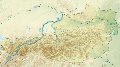
 Verlaufskarte Inn DE.png 2,117 × 1,882; 5.54 MB
-
 خريطة وادِي إِن.jpg 336 × 464; 31 KB


