Category:Maps of the Gulf of Saint Lawrence
Jump to navigation
Jump to search
Subcategories
This category has only the following subcategory.
Media in category "Maps of the Gulf of Saint Lawrence"
The following 30 files are in this category, out of 30 total.
-
1voyageJacquesCartier.jpg 608 × 636; 81 KB
-
Admiralty Chart No 1135 Seven Islands Bay, Published 1956.jpg 11,170 × 8,154; 32.24 MB
-
Bataille du Saint-Laurent1 couleur.jpg 1,075 × 902; 403 KB
-
Carte du Golphe de St-Laurent et Pays Voisins.png 1,375 × 870; 2.51 MB
-
Cartier First Voyage Map 1 fr.png 636 × 552; 47 KB
-
Cartier First Voyage Map 1.png 636 × 552; 55 KB
-
Cartier Second Voyage Map 1 fr.png 831 × 567; 91 KB
-
Cartier Second Voyage Map 1.png 831 × 567; 103 KB
-
Coraux Eponges StLaurent.svg 1,343 × 970; 310 KB
-
Golfe Saint-Laurent de.png 600 × 555; 102 KB
-
Golfe Saint-Laurent Delimitations-fr.png 2,000 × 1,819; 530 KB
-
Golfe Saint-Laurent Delimitations-fr.svg 512 × 466; 83 KB
-
Golfe Saint-Laurent Depths fr.svg 1,655 × 1,582; 3.05 MB
-
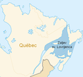
Golfe Saint-Laurent en.png 600 × 555; 101 KB
-
Golfe Saint-Laurent fr.png 600 × 555; 102 KB
-
Golfe Saint-Laurent hr.png 600 × 555; 91 KB
-
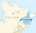
Golfe Saint-Laurent ja.png 600 × 555; 101 KB
-
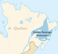
Golfe Saint-Laurent pl.png 600 × 555; 103 KB
-
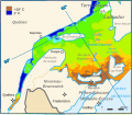
Golfe Saint-Laurent Temperatures fr.svg 1,414 × 1,231; 75 KB
-
Golfe Saint-Laurent Tide amplitude fr.svg 811 × 855; 188 KB
-
Gulf of Saint Lawrence 2.jpg 734 × 456; 99 KB
-
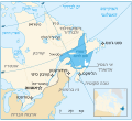
Gulf of Saint Lawrence Map he.svg 830 × 755; 147 KB
-
Gulf of Saint Lawrence.jpg 734 × 456; 99 KB
-
Map of Gulf of Saint Lawrence-No names.png 1,059 × 944; 307 KB
-
Map of Gulf of Saint Lawrence02.png 406 × 271; 43 KB
-
Marine Atlantic ferry ports.png 534 × 747; 22 KB
-
Old Harry oil field location map-fr.svg 1,655 × 1,582; 3.04 MB
-
StLawrence Gulf bathymetry.jpg 820 × 505; 90 KB


