Category:Maps of the Gulf of Morbihan
Jump to navigation
Jump to search
Subcategories
This category has only the following subcategory.
Media in category "Maps of the Gulf of Morbihan"
The following 16 files are in this category, out of 16 total.
-
Admiralty Chart No 2358 Morbihan, Published 1944, New Edition 1957.jpg 17,601 × 11,253; 60.13 MB
-
Admiralty Chart No 2359 Entree de Morbihan, Published 1944.jpg 11,103 × 16,227; 63.93 MB
-
Bataille Morbihan -56 he.png 1,842 × 1,125; 84 KB
-
Carte du Morbihan et la presqu'ile de Quiberon - Bellin - btv1b8591953b.jpg 5,773 × 3,901; 3.81 MB
-
Côte Sud Morbihan - Baie de Quiberon.png 418 × 452; 134 KB
-
Golfe du Morbihan Carte de Cassini.jpg 1,031 × 660; 561 KB
-
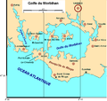
Golfe du morbihan.png 785 × 748; 51 KB
-
Gulf of Morbihan location map-blank.svg 2,626 × 2,224; 807 KB
-
Gulf of Morbihan relief location map-blank.svg 2,626 × 2,224; 2.94 MB
-
Plan du Havre de Morbian... - btv1b53012778b.jpg 12,214 × 8,689; 15.83 MB
-
The Chastity Plan.jpg 800 × 1,026; 182 KB
-
The coast of BRETAGNE from Port Douelan to Point Penvis NYPL1640597.tiff 7,230 × 5,428; 112.28 MB


