Category:Maps of the Greenland Sea
Jump to navigation
Jump to search
Media in category "Maps of the Greenland Sea"
The following 38 files are in this category, out of 38 total.
-
1598 map of the Polar Regions by Willem Barentsz.jpg 13,719 × 10,160; 30.66 MB
-
Admiralty Chart No 2282 Arctic Ocean and Greenland Sea, Published 1872.jpg 15,062 × 12,375; 19.49 MB
-
Barents third voyage.jpg 2,000 × 1,511; 965 KB
-
Barentskartet, 1598 (12068020364).jpg 2,842 × 2,091; 3.85 MB
-
Barentsz Full Map.jpg 1,000 × 742; 258 KB
-
CARTE GEO MARITIME MER DU GROENLAND - Scoresby Sund.jpg 499 × 419; 55 KB
-
CARTE GEO MARITIME MER DU GROENLAND - Scoresby Sund2.jpg 505 × 315; 47 KB
-
Forminsket utgave av Barentskartet - no-nb krt 00487.jpg 4,418 × 3,449; 3.45 MB
-
Germania Land - crop of Operational Navigation Chart B-9, 1st edition.jpg 1,734 × 1,695; 1,000 KB
-
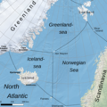
GIN-Seas-en (cropped).png 858 × 855; 993 KB
-
GIN-Seas-en.png 1,082 × 1,106; 1.6 MB
-
GIN-See.png 1,082 × 1,106; 1.59 MB
-
Groenlandzee.PNG 736 × 515; 19 KB
-
Karte Europäisches Nordmeer.png 1,000 × 913; 291 KB
-
Map of the Nordic Seas.jpg 722 × 579; 212 KB
-
N-Atlantic-topo (de).png 502 × 354; 288 KB
-
N-Atlantic-topo.png 504 × 352; 288 KB
-
Norveško more.svg 1,000 × 913; 492 KB
-
Norvég-tenger térkép 2.png 1,000 × 913; 416 KB
-
Norwegian Sea map ce.svg 857 × 783; 473 KB
-
Norwegian Sea map ch.png 1,000 × 913; 365 KB
-
Norwegian Sea map cs.png 1,000 × 913; 414 KB
-
Norwegian Sea map hr.svg 857 × 783; 533 KB
-
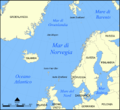
Norwegian Sea map it.png 1,000 × 913; 413 KB
-
Norwegian Sea map mk.svg 857 × 783; 483 KB
-
Norwegian Sea map no.png 1,000 × 913; 406 KB
-
Norwegian Sea map ru.svg 857 × 783; 574 KB
-
Norwegian Sea map sv.png 1,000 × 913; 360 KB
-
Norwegian Sea map uk.svg 857 × 783; 330 KB
-
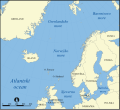
Norwegian Sea map.png 1,000 × 913; 513 KB
-
Operational Navigation Chart A-1, 1st edition.jpg 9,254 × 6,693; 10.46 MB
-
Operational Navigation Chart B-1, 3rd edition.jpg 9,254 × 6,672; 10.24 MB
-
Operational Navigation Chart B-9, 1st edition.jpg 9,254 × 6,650; 11 MB
-
Operational Navigation Chart C-1, 1st edition.jpg 9,254 × 6,667; 10.96 MB
-
Pontanus 1611 Arctic Map.jpg 2,852 × 2,142; 802 KB
-
Scottish geographical magazine (1885) (14780932474).jpg 3,184 × 1,036; 374 KB


