Category:Maps of the Great Northern War
Jump to navigation
Jump to search
Subcategories
This category has only the following subcategory.
M
Media in category "Maps of the Great Northern War"
The following 57 files are in this category, out of 57 total.
-
Great Northern War Part2.png 1,300 × 1,813; 3.4 MB
-
Alliierte und Dänische Armeen Juli 1700 Segeberg.jpg 1,738 × 1,417; 1.67 MB
-
Armfeldt Campaign in Norway 1718.svg 5,176 × 4,018; 991 KB
-
Battle of Kotlin Island 1705.jpg 7,777 × 5,193; 4.97 MB
-
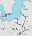
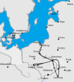
Campaign of Grodno.jpg 340 × 377; 39 KB
-
Courland in 1702.png 1,847 × 1,181; 3.75 MB
-
Dorpat 1704.jpg 499 × 411; 62 KB
-
Estland BV042516127 (cropped).jpg 1,433 × 1,395; 284 KB
-
Europa Nordost BV042516129 (cropped).jpg 1,241 × 1,672; 212 KB
-
Finnland BV042514142.jpg 1,470 × 2,565; 452 KB
-
Finnland BV042514862 (cropped).jpg 1,438 × 1,635; 338 KB
-
Finnland BV042514945 (cropped).jpg 1,583 × 1,199; 346 KB
-
Finnland BV043420542 (cropped).jpg 1,523 × 1,343; 280 KB
-
Finnland BV043420596 (cropped).jpg 1,302 × 1,602; 342 KB
-
Finnland BV043420606 (cropped).jpg 830 × 984; 111 KB
-
Gran Guerra del Norte Fase1.png 1,300 × 1,813; 3.48 MB
-
Gran Guerra del Norte Fase2.png 1,300 × 1,813; 3.4 MB
-
Great Northern War Baltic Theater.png 619 × 506; 483 KB
-
Great Northern War Part1.png 1,300 × 1,813; 3.49 MB
-
Great nothern war map.JPG 750 × 418; 73 KB
-
Grosser Nordischer Krieg Phase1.png 1,300 × 1,813; 3.5 MB
-
Grosser Nordischer Krieg Phase2.png 1,300 × 1,813; 3.41 MB
-
Großer Nordischer Krieg in Pommern.PNG 544 × 525; 239 KB
-
Holowczyn 1708.png 1,345 × 2,190; 6.13 MB
-
Holowczynkrigsplan.jpeg 1,213 × 1,055; 749 KB
-
Ingermanland 1700 bis 1704.png 800 × 892; 203 KB
-
Ingermanland 1708.png 703 × 725; 215 KB
-
Karl XIIs polska fälttåg 1700-1706.png 340 × 377; 18 KB
-
Karl XIIs polska fälttåg 1702-03.png 340 × 377; 24 KB
-
Karl XIIs polska fälttåg 1704-05.png 340 × 377; 26 KB
-
Karl XIIs polska fälttåg 1706.png 340 × 377; 28 KB
-
Lager der polnischen und schwedischen Truppen entlang der Düna, 1700.jpg 1,200 × 260; 97 KB
-
Map depicting the Russian fleet on its way to attack Umeå.jpg 7,203 × 4,713; 2.58 MB
-
Map of some battle in the Pruth Area.jpg 1,521 × 1,813; 747 KB
-
Map of the Great Northern War Theatre from a Russian book.jpg 1,461 × 2,092; 365 KB
-
Map of unidentified battle of the Nordic War in 1711 in Moldova.jpg 1,017 × 1,663; 586 KB
-
Narwafeldzug 1700.jpg 1,160 × 581; 127 KB
-
No-nb krt 00748 (12084591225).jpg 3,507 × 4,600; 22.68 MB
-
Rysshärjningarna i Nyköping 1719.svg 1,052 × 744; 901 KB
-
Rügen 1712.jpg 1,201 × 1,752; 211 KB
-
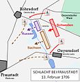
Schlacht bei Fraustadt 1706.jpg 628 × 644; 132 KB
-
Slaget vid Kliszów 1702 Slagets Gång.png 1,363 × 1,226; 1.68 MB
-
Slaget vid Kliszów 1702 Slagordning.png 1,378 × 1,046; 1.35 MB
-
Swe-Nor01.jpg 654 × 867; 189 KB
-
Карта-схема к статье «Митава». Военная энциклопедия Сытина (Санкт-Петербург, 1911-1915).jpg 5,555 × 4,116; 5.05 MB
-
Ниеншанц. План осады крепости Ниеншанц в 1703г изд.1861 ГИМ e1.jpg 1,733 × 1,233; 531 KB
-
План сражения при дер.Лесной 1708г p97 (p)1883 e1t2.jpg 1,219 × 805; 603 KB
-
Победа над шведским флотом на р.Амовже в 1704г.(с)Худ.АдрианШхонебек, XVIIIв. ГИМ e1.jpg 1,598 × 1,375; 848 KB


