Category:Maps of the Georgian Soviet Socialist Republic
Jump to navigation
Jump to search
Subcategories
This category has the following 2 subcategories, out of 2 total.
Media in category "Maps of the Georgian Soviet Socialist Republic"
The following 26 files are in this category, out of 26 total.
-
Caucasiamapussr-ar.gif 739 × 623; 199 KB
-
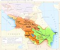
Caucasiamapussr.gif 700 × 590; 81 KB
-
Georgian soviet republic1922-corrected.png 1,368 × 836; 62 KB
-
Georgian soviet republic1922.png 1,368 × 836; 76 KB
-
Georgian SSR 1922 hy.png 800 × 489; 97 KB
-
Georgian soviet republic1957 1991.png 1,461 × 768; 63 KB
-
Georgian soviet republic (1957-1991)-sr.png 1,461 × 768; 23 KB
-
Georgian SSR 1957 hy.png 1,461 × 768; 44 KB
-
Gruzinskaya Ssr Map 15 - DPLA - 5d72b86782820dbc87fa7cbd3788df09.jpg 11,393 × 7,626; 10.65 MB
-
Main Roads Caucasus region USSR 1960-1982.svg 2,657 × 1,736; 251 KB
-
Main Roads Georgia 1982-1996.svg 2,657 × 1,736; 561 KB
-
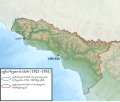
Map of SSR Abkhazia (1921-1931)-ka.svg 647 × 545; 7.7 MB
-
SouthCaucasus.jpg 700 × 590; 135 KB
-
Soviet Caucasus map hu.svg 747 × 629; 281 KB
-
Soviet Caucasus map-es.svg 2,424 × 2,000; 776 KB
-
Soviet Caucasus map.svg 747 × 629; 731 KB
-
Soviet territorial claims against Turkey 1945-1953.png 2,000 × 1,579; 395 KB
-
Soviet-caucasus1922Arabic.jpg 1,008 × 720; 89 KB
-
Soviet caucasus1922.png 1,613 × 1,152; 127 KB
-
Soviet-caucasus1922.png 1,613 × 1,090; 92 KB
-
Territorial claims of the Georgian SSR against Turkey, 1946.png 2,967 × 2,500; 842 KB
-
USSR territorial claims to Turkey.svg 736 × 581; 1.83 MB
-
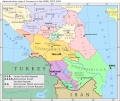
Zakavkazye 1952-1953.png 1,473 × 1,010; 162 KB
-
پەیمانی قەرس.jpg 1,399 × 787; 188 KB


