Category:Maps of the Free State of Prussia
Jump to navigation
Jump to search
Media in category "Maps of the Free State of Prussia"
The following 17 files are in this category, out of 17 total.
-
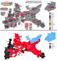
1919 Prussian Constituency Assembly election - Results.svg 1,107 × 1,363; 1.12 MB
-
1921 Prussian Landtag election - Results.svg 1,107 × 1,192; 1.06 MB
-
1921 Prussian state election.svg 6,021 × 3,479; 1.7 MB
-
1924 Prussian Landtag election - Results.svg 1,182 × 1,272; 914 KB
-
1924 Prussian state election.svg 6,021 × 3,479; 1.89 MB
-
1928 Prussian Landtag election - Results.svg 1,182 × 1,272; 905 KB
-
1928 Prussian state election.svg 6,021 × 3,479; 1.94 MB
-
1932 Prussian Landtag election - Results.svg 1,182 × 1,272; 902 KB
-
1932 Prussian state election.svg 6,021 × 3,479; 2.01 MB
-
Free State of Prussia (1918–1935).svg 1,000 × 800; 369 KB
-
Prussia in the German Reich (1925).svg 1,425 × 1,133; 967 KB
-
Map-WR-Prussia.svg 1,185 × 1,007; 542 KB
-
Map-WR-PrussiaProvs-1920.svg 1,185 × 1,007; 591 KB
-
PruisenRB1922.png 1,307 × 987; 43 KB
-
Prussia 1925.png 945 × 762; 77 KB
-
Volksbegehren Landtagsauflösung 1931.svg 1,119 × 825; 183 KB
-
Volksentscheid Landtagsauflösung 1931.svg 1,182 × 825; 183 KB


