Category:Maps of the Firth of Clyde
Jump to navigation
Jump to search
Subcategories
This category has the following 2 subcategories, out of 2 total.
M
- Maps of Holy Loch (7 F)
- Maps of Loch Fyne (15 F)
Media in category "Maps of the Firth of Clyde"
The following 35 files are in this category, out of 35 total.
-

-

-

-

-

-

-

-
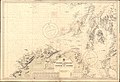 Admiralty Chart No 1577 Western approaches to the Firth of Clyde, Published 1913.jpg 16,242 × 11,122; 53.29 MB
-
 Admiralty Chart No 1907 Cloch Point to Little Cumbrae Island, Published 1969.jpg 11,200 × 18,788; 22.07 MB
-
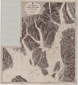
 Admiralty Chart No 1966 Scotland West Coast sheet II. Frith of Clyde &c., Surveyed 1846.jpg 10,196 × 8,078; 19.57 MB
-
 Admiralty Chart No 1994 River Clyde - Dunoon to Port Glasgow, Published 1943.jpg 10,377 × 6,466; 28.65 MB
-
 Admiralty Chart No 2131 Firth of Clyde & Loch Fyne, Published 1956.jpg 6,836 × 9,816; 30.32 MB
-
 Admiralty Chart No 2131 Firth of Clyde, between Little Cumbrae and Toward Point, Published 1852.jpg 8,190 × 10,978; 19.15 MB
-
 Admiralty Chart No 2131 Scotland west coast Firth of Clyde, Published 1891.jpg 10,896 × 11,809; 23.16 MB
-
 Admiralty Chart No 2132 Firth of Clyde - sheet 2, Published 1852.jpg 7,879 × 10,530; 20.1 MB
-

-
 Admiralty Chart No 2159 Firth of Clyde, Published 1869.jpg 11,193 × 19,484; 22.08 MB
-
 Admiralty Chart No 2159 The Clyde, Loch Fyne &c., Published 1852.jpg 10,551 × 7,926; 19.25 MB
-
 Admiralty Chart No 2164 Fith of Clyde Bennane Head to Largs Channel, Published 1969.jpg 11,302 × 16,359; 23.06 MB
-
 Admiralty Chart No 2494 Ayr to Ardrossan, Published 1941.jpg 8,363 × 12,172; 26.75 MB
-
 Admiralty Chart No 2724 Approaches to the Firth of Clyde, Published 1970.jpg 11,280 × 16,334; 22.32 MB
-
 Dunbartonshire Forts.svg 1,082 × 798; 996 KB
-
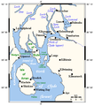 Firthofclydemap.png 541 × 611; 18 KB
-
 Fullarton estate 1828.jpg 4,256 × 3,184; 1.52 MB
-
 Ordnance Survey One-Inch Sheet 59 Firth of Clyde, Published 1956.jpg 8,619 × 10,676; 9.7 MB
-
 Ordnance Survey One-Inch Sheet 59 Firth of Clyde, Published 1965.jpg 8,314 × 9,866; 11.22 MB
-
 Ordnance Survey One-Inch Sheet 66 Loch Lomond, Published 1945.jpg 9,716 × 7,430; 9.61 MB
-
 Ordnance Survey One-Inch Sheet 71 Island of Bute, Published 1945.jpg 12,194 × 11,215; 14.01 MB
-
 Ordnance Survey One-Inch Sheet 72 Glasgow, Published 1945.jpg 14,410 × 11,422; 22.28 MB
-
 Ordnance Survey Quarter-inch sheet 3 The Forth, Clyde & Tay, published 1946.jpg 13,238 × 10,969; 16.2 MB
-
 Ordnance Survey Quarter-inch sheet 6 Firth of Clyde, published 1965.jpg 9,628 × 8,893; 10.55 MB
-
 Ordnance Survey Quarter-inch sheet 6 Firth of Clyde, published 1973.jpg 12,916 × 11,785; 63.56 MB
-
 River clyde outline.png 1,125 × 606; 14 KB
-
 Scotland Map (Firth of Clyde Detail).png 250 × 158; 15 KB
-
 The earth and its inhabitants (1882) (14750196046).jpg 2,036 × 1,720; 747 KB
.jpg)
_(14804961633).jpg)
.jpg)
.jpg)
.jpg)


.png)
_(14750196046).jpg)
_Edited_by_E._G._Ravenstein_..._Illustrated,_etc%27_(11186617966).jpg)
_Edited_by_E._G._Ravenstein_..._Illustrated,_etc%27_(11188016465).jpg)