Category:Maps of the Far Eastern Republic
Jump to navigation
Jump to search
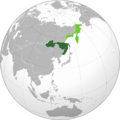
The Far Eastern Republic was proclaimed de facto independant from the imperial Russia between 1920 and 1922, before its annexion into the Russian SFSR (with the exception of the southern part of Sakhaline, maintained occupied by Japan until 1925).
Media in category "Maps of the Far Eastern Republic"
The following 8 files are in this category, out of 8 total.
-
1922 Map of the Far Eastern Republic.jpg 2,400 × 1,474; 1.26 MB
-
Far Eastern Republic (orthographic projection).png 1,995 × 1,995; 730 KB
-
Far Eastern Republic (orthographic projection).svg 536 × 536; 373 KB
-
Far Eastern Republic.jpg 800 × 667; 321 KB
-
Far eastern republic.png 350 × 413; 20 KB
-
Map of the Far Eastern Republic (initial position).svg 512 × 516; 54 KB
-
Map of the Far Eastern Republic (september 1920).svg 512 × 515; 56 KB
-
Silhouette of Far Eastern Republic.svg 900 × 545; 39 KB


