Category:Maps of the European Union and the United Kingdom
Jump to navigation
Jump to search
Media in category "Maps of the European Union and the United Kingdom"
The following 20 files are in this category, out of 20 total.
-
EEC-6 United Kingdom Locator (with internal borders).svg 680 × 520; 493 KB
-
EEC-6 United Kingdom Locator.svg 680 × 520; 446 KB
-
EU location UK.png 1,600 × 1,200; 473 KB
-
Eu location uk.svg 1,600 × 1,200; 2.58 MB
-
Europe Location UK.svg 393 × 294; 887 KB
-
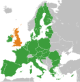
United Kingdom European Union Locator.svg 593 × 606; 711 KB
-
European Union UK withdrawal.svg 680 × 520; 587 KB
-
European Union United Kingdom Locator (extended map).svg 593 × 606; 710 KB
-
European Union United Kingdom Locator (territories lighter).svg 593 × 606; 711 KB
-
European Union United Kingdom Locator.svg 593 × 606; 711 KB
-
Location map of the United Kingdom and the European Union.svg 593 × 606; 708 KB
-
United Kingdom (+overseas territories and crown dependencies) in the World (+EU).svg 2,521 × 1,260; 2.34 MB
-
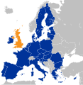
United Kingdom and European Union (Red-Blue).svg 593 × 606; 711 KB
-
United Kingdom and the European Union (orthographic projection).png 537 × 537; 170 KB
-
United Kingdom in European Union (-rivers -mini map).svg 1,401 × 1,198; 812 KB
-
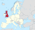
United Kingdom in European Union.svg 1,401 × 1,198; 2.43 MB
-
United Kingdom in the European Union and in the world (EU-UK only) (W3).svg 3,188 × 1,949; 3.11 MB
-
United Kingdom in the European Union on the globe (Europe centered).svg 1,032 × 1,032; 313 KB


