Category:Maps of the Elbe in Czechia
Jump to navigation
Jump to search
Media in category "Maps of the Elbe in Czechia"
The following 10 files are in this category, out of 10 total.
-
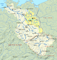
Elbe Einzugsgebiet.png 1,309 × 1,381; 1.96 MB
-
Brandýs nad Labem, Ostrůvek.png 578 × 579; 420 KB
-
Elbe basin.png 1,309 × 1,381; 1.8 MB
-
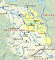
Spree-Havel in Elbe basin, cut.png 787 × 863; 723 KB
-
Spree-Havel in Elbe basin.png 1,309 × 1,381; 1.79 MB
-
Elbe tributaries discharge diagram mk.svg 1,600 × 1,200; 440 KB
-
Karel Škréta ml. Mapa Čech (1679).png 800 × 775; 1.35 MB
-
Rozcestník Děčín-Tyršův most.jpg 2,448 × 3,264; 1.65 MB
-
Elbe tributaries discharge diagram.svg 1,600 × 1,200; 23 KB


