Category:Maps of the Eighty Years' War
Jump to navigation
Jump to search
Subcategories
This category has the following 3 subcategories, out of 3 total.
B
M
- Maps of Siege of Leiden (30 F)
Media in category "Maps of the Eighty Years' War"
The following 23 files are in this category, out of 23 total.
-
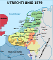
Map Union of Arras and Utrecht 1579-hu.svg 750 × 860; 134 KB
-
Map Union of Arras and Utrecht 1579-nl.svg 749 × 872; 139 KB
-
Utrecht-Atrecht keerte 1579.gif 488 × 583; 58 KB
-
57 of 'Cusack's Reign of Queen Elizabeth for scholarship candidates' (11231752616).jpg 1,190 × 1,829; 533 KB
-
Achtermeer polder 1573.jpg 430 × 600; 53 KB
-
Beleegeringe vande stadt Hertogen Bosch - btv1b53042047x.jpg 4,613 × 3,689; 4.02 MB
-
Belegerung der Stat Harlem in Hollant... - btv1b55004998s.jpg 7,746 × 5,979; 5.24 MB
-
Campaign Map of Prince of Orange vs Duke of Alva November and December 1568.jpg 1,204 × 780; 290 KB
-
Campaign Map of Prince of Orange vs Duke of Alva October 1568.jpg 1,162 × 856; 287 KB
-
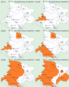
Demonstration gif graafschap zutphen during the 80 years of war.gif 716 × 599; 1.09 MB
-
Enschede jvd.jpg 531 × 439; 315 KB
-
Ferrarisbaasrode.jpg 596 × 480; 57 KB
-
Gelegenheit des Bommeler Wehrts vnd der Schenckischen Schanzen. (BM 1880,0710.348).jpg 2,500 × 1,510; 772 KB
-
Nederlanden 1579.PNG 639 × 880; 370 KB
-
Nederlanden 1590-1592-es.svg 1,546 × 2,028; 2.3 MB
-
Nederlanden 1597-es.svg 1,546 × 2,028; 1.77 MB
-
Tachtigjarige Oorlog 1574-1575-es.svg 1,651 × 2,162; 2.5 MB
-
Tachtigjarigeoorlog-1586-1587-es.svg 1,546 × 2,028; 2.36 MB
-
The Low Countries.png 863 × 1,011; 88 KB


