Category:Maps of the East China Sea
Jump to navigation
Jump to search
Subcategories
This category has only the following subcategory.
Media in category "Maps of the East China Sea"
The following 49 files are in this category, out of 49 total.
-
East China Sea Map.jpg 600 × 533; 88 KB
-
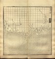
Guang yu tu - er juan LOC 2008623187-36.jpg 4,360 × 4,658; 5.07 MB
-
Guang yu tu - er juan LOC 2008623187-36.tif 4,360 × 4,658; 58.1 MB
-
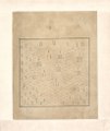
Guang yu tu - er juan LOC 2008623187-37.jpg 4,360 × 4,658; 4.53 MB
-
Guang yu tu - er juan LOC 2008623187-37.tif 4,360 × 4,658; 58.1 MB
-
Fen ye yu tu. LOC 2002626777-23.jpg 4,236 × 5,020; 1.92 MB
-
Fen ye yu tu. LOC 2002626777-23.tif 4,236 × 5,020; 60.84 MB
-
1786年中国往琉球海路图2.jpg 2,130 × 1,450; 325 KB
-
Nan bei yang he tu. LOC gm71005215.jpg 5,106 × 7,122; 4.64 MB
-
Nan bei yang he tu. LOC gm71005215.tif 5,106 × 7,122; 104.04 MB
-
Nan yang fen tu. LOC gm71005139.jpg 5,100 × 7,186; 5.22 MB
-
Nan yang fen tu. LOC gm71005139.tif 5,100 × 7,186; 104.85 MB
-
East China Sea, Pergamon World Atlas 1967.jpg 1,897 × 2,406; 926 KB
-
1971) East China Sea (30583779680).jpg 3,270 × 4,258; 15.07 MB
-
Admiralty Chart Catalogue 1967 Page 068 Index K.jpg 8,572 × 6,843; 9.86 MB
-
Admiralty Chart Catalogue 1967 Page 071 Index K1.jpg 8,573 × 6,828; 8.49 MB
-
Admiralty Chart No 1754 Tung-Yin Shan to Wen-Chou Wan, Published 1960.jpg 16,328 × 11,123; 42.65 MB
-
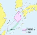
Air Defense Identification Zone of Japan.PNG 1,280 × 1,080; 99 KB
-
Air Defense Identification Zone of Japan3.png 1,280 × 1,080; 75 KB
-
Carte des îles Formose (34167570590).jpg 1,200 × 1,028; 624 KB
-
China ADIZ map from VOA.png 640 × 360; 251 KB
-
China Dongfang Spaceport sea launch area map.png 1,128 × 1,602; 810 KB
-
Der Riukiu-Inselbogen und seine Ansätze an Kiuschiu und Formosa 1902.tif 3,940 × 3,971; 34.61 MB
-
E0171497 7481621.jpg 900 × 772; 364 KB
-
East China Sea Air Defense Identification Zone (chinese).png 500 × 351; 165 KB
-
East China Sea Air Defense Identification Zone.png 500 × 351; 168 KB
-
East China sea digging map.svg 459 × 448; 647 KB
-
East China Sea Fixed.png 670 × 382; 191 KB
-
East China Sea in its region.svg 500 × 281; 4.82 MB
-
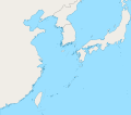
East China Sea location map OSM eqc.svg 1,360 × 1,200; 162 KB
-
East China Sea location map OSM.svg 1,360 × 1,200; 153 KB
-
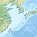
East China Sea map with topography border.png 755 × 755; 520 KB
-
East China Sea natural gas field problem (China - Japan) NT.PNG 560 × 600; 58 KB
-
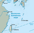
East China Sea ru.png 500 × 490; 168 KB
-
East China Sea.jpg 1,280 × 958; 275 KB
-
East China Sea.PNG 670 × 382; 190 KB
-
JADIZ and CADIZ and KADIZ in East China Sea (blank map).png 1,526 × 1,585; 2.26 MB
-
JADIZ and CADIZ and KADIZ in East China Sea.jpg 1,526 × 1,585; 786 KB
-
Japan Korea JDZ J.png 954 × 909; 105 KB
-
Japan Korea JDZ J.svg 458 × 436; 627 KB
-
Japan Korea JDZ K.png 954 × 909; 94 KB
-
Map of the East China Sea.jpg 231 × 155; 42 KB
-
OpenSeaMap-ChartBundleArea-EastChineseSea-2016-05.PNG 817 × 981; 589 KB
-
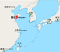
Qingdao in NEA.svg 1,300 × 1,130; 296 KB
-
Socotra Rock.png 1,650 × 1,128; 496 KB
-
Проекция Альберса (GMT).gif 1,000 × 600; 43 KB
-
Равноугольная коническая проекция Ламберта.gif 882 × 504; 35 KB
-
中山传信录往琉球2.jpg 929 × 844; 436 KB
-
中山传信录往琉球A.jpg 911 × 845; 464 KB


