Category:Maps of the Duchy of Milan
Jump to navigation
Jump to search
Subcategories
This category has the following 5 subcategories, out of 5 total.
1
Media in category "Maps of the Duchy of Milan"
The following 62 files are in this category, out of 62 total.
-
Expansión de Milán y Florencia.png 797 × 1,256; 2.71 MB
-
The Milanese under the Visconti.jpg 789 × 763; 372 KB
-
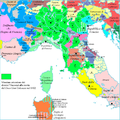
DuchyofMilan1400.png 375 × 243; 7 KB
-
Ducato di Milano, 1402.svg 558 × 595; 174 KB
-
Duchy of Milan (1402).svg 3,264 × 3,837; 254 KB
-
Map of Italy (1402)-fr.svg 3,264 × 3,837; 336 KB
-
Massima espansione Viscontea.png 1,000 × 1,004; 287 KB
-
Italy 1494 shepherd detail.jpg 781 × 669; 699 KB
-
Italy 1494 shepherd.jpg 1,629 × 2,282; 1.39 MB
-
Location of the Duchy of Milan-es.svg 3,245 × 3,948; 1.06 MB
-
Location of the Duchy of Milan-it-zoom.svg 2,200 × 1,800; 675 KB
-
Location of the Duchy of Milan-it.svg 3,245 × 3,948; 918 KB
-
Location of the Duchy of Milan-no.svg 3,245 × 3,948; 918 KB
-
Map of Italy (1494)-ca.svg 3,245 × 3,948; 537 KB
-
Map of Italy (1494)-en.svg 3,461 × 4,211; 403 KB
-
Map of Italy (1494)-fr.svg 3,245 × 3,948; 534 KB
-
Map of Italy (1494)-it-2.png 493 × 600; 103 KB
-
Map of Italy (1494)-it.svg 3,245 × 3,948; 536 KB
-
Map of Italy (1494)-mk.svg 3,245 × 3,948; 1.11 MB
-
Map of Italy (1494)-pl.svg 3,245 × 3,948; 534 KB
-
Map of Italy 1494-es.svg 3,245 × 3,948; 779 KB
-
Stato di Milano - Gio. Ant. Magini - btv1b530424159.jpg 5,682 × 4,361; 5.14 MB
-
Map of the Duchy of Milan by Abraham Ortelius.jpeg 1,574 × 1,189; 629 KB
-
Atlas ou Representation du Monde Universel t. 2. 1633 (110102381).jpg 17,062 × 11,970; 34.83 MB
-
Ducato ouero territorio di Milano - CBT 5880995.jpg 5,382 × 4,278; 6.17 MB
-
Atlas Van der Hagen-KW1049B12 063-STATO DI MILANO.jpeg 5,500 × 4,324; 4.27 MB
-
"Ducato overo territorio di Milano" (22228636516).jpg 4,056 × 3,078; 2.38 MB
-
"Stato di Milano" (22254704215).jpg 3,906 × 3,066; 2.57 MB
-
Duché de Milan - btv1b53042074t.jpg 6,676 × 4,255; 3.24 MB
-
Pavie, ville du duché de Milan - btv1b8440615p.jpg 8,915 × 7,188; 12.73 MB
-
Milan. - Stato di Milano e provincie confinanti dalla parte orientale... - btv1b8441321p.jpg 10,278 × 7,306; 13.27 MB
-
Atlante Topografico dello Stato di Milano, Carta generale, Tavola A1.jpg 4,608 × 6,144; 3.59 MB
-
Atlante Topografico dello Stato di Milano, Carta generale, Tavola A2.jpg 2,304 × 3,072; 1.73 MB
-
C. 1494 Italy.jpg 1,298 × 1,727; 2.71 MB
-
C. 1560 Savoy and Italy.jpg 1,144 × 1,174; 1.15 MB
-
C. 1650 Italian Peninsula.jpg 748 × 787; 681 KB
-
C. 1796 Northern Italy.jpg 1,267 × 1,211; 1.58 MB
-
Duché de Milan - btv1b530421924.jpg 6,027 × 4,580; 4.82 MB
-
Italy in 1859 (Johnston).jpg 1,509 × 1,763; 1.32 MB
-
La partie méridionale des états de Milan ... - btv1b530422912.jpg 4,927 × 3,677; 3.86 MB
-
Map of Italy (1402)-ca.svg 3,264 × 3,837; 322 KB
-
Mediolanum ducatus - btv1b53042048c (1 of 2).jpg 6,112 × 4,739; 5.66 MB
-
Pievi Milanesi 1757.svg 529 × 600; 1.34 MB
-
Gerardi Mercatoris Atlantis Novi. Pars Tetria 1638 (112387383).jpg 18,369 × 13,724; 43.62 MB


