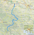
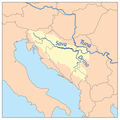
Category:Maps of the Drina watercourse system
Jump to navigation
Jump to search
Media in category "Maps of the Drina watercourse system"
The following 11 files are in this category, out of 11 total.
-
Drina et sont affluent la Lešnica.jpg 734 × 562; 211 KB
-
Drina Oberlauf.jpg 1,574 × 1,108; 271 KB
-
Drina river catchment October 20 2000 HSV 457.jpg 3,671 × 8,965; 38.85 MB
-
Drina Sat.png 1,023 × 3,041; 5.5 MB
-
Drina.png 503 × 510; 575 KB
-
Podrinje.png 1,809 × 1,752; 112 KB
-
Savarivermap ru.png 300 × 300; 48 KB
-
Savarivermap tr.png 300 × 300; 59 KB
-
Se-dinaric river basins cikovac.jpg 3,145 × 4,070; 908 KB
-
Serbia river basins hydrology pavle cikovac.jpg 3,825 × 4,950; 1.22 MB
-
Srem Sat.png 1,024 × 702; 1.44 MB


