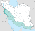
Category:Maps of the Diyala River in Iran
Jump to navigation
Jump to search
Media in category "Maps of the Diyala River in Iran"
The following 5 files are in this category, out of 5 total.
-
Diyala river.PNG 625 × 531; 49 KB
-
IranCatchKhF1.svg 512 × 457; 337 KB
-
Near East topographic map with toponyms 3000bc-pt.svg 1,426 × 1,083; 10.04 MB
-
Neolitico ceramico, calcolitico e bronzo antico nel Vicino Oriente.jpg 3,814 × 2,900; 1.31 MB
-
Siti neolitici del Vicino Oriente.jpg 4,425 × 2,900; 1.14 MB


