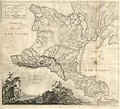
Category:Maps of the Crimean Peninsula
Jump to navigation
Jump to search
Subcategories
This category has the following 2 subcategories, out of 2 total.
M
- Maps of the Kerch Peninsula (10 F)
Media in category "Maps of the Crimean Peninsula"
The following 25 files are in this category, out of 25 total.
-
125 of '(British Battles on Land and Sea.)' (11169375665).jpg 1,938 × 1,763; 685 KB
-
1776 map of the Crimean peninsula.jpg 10,763 × 9,795; 11.04 MB
-
Carte de la Crimée pour suivre les opérations de la guerre d'orient.jpg 10,498 × 7,382; 6.14 MB
-
Crimea topographic blank for translation.png 3,140 × 2,043; 1.57 MB
-
CrimeaflickrCrimea Summer 05 010a.jpg 615 × 410; 145 KB
-
Crimean Federal District (numbered).svg 532 × 353; 110 KB
-
Crimean Mountains Chains.JPG 800 × 542; 74 KB
-
Crimea republic map.png 1,031 × 684; 65 KB
-
Crimea republic map1.png 1,031 × 684; 63 KB
-
Karte der Krim.png 2,283 × 1,485; 1,014 KB
-
Krim 500.png 500 × 307; 20 KB
-
Krim.png 800 × 600; 77 KB
-
Krim3.png 800 × 600; 133 KB
-
Krimmi poolsaar.png 1,024 × 703; 815 KB
-
Krym regions.svg 1,698 × 1,073; 655 KB
-
Map of the Crimea - RU.png 2,283 × 1,485; 1 MB
-
Map of the Crimea.png 2,283 × 1,485; 984 KB
-
Map of the Crimean Peninsula.png 622 × 400; 44 KB
-
Physical map of the Crimea.jpg 3,289 × 2,139; 2.28 MB
-
Physische Karte der Krim.jpg 3,289 × 2,139; 4.36 MB
-
Półwysep Krymski.png 1,333 × 903; 1.39 MB
-
Qırım haritası.svg 1,000 × 678; 87 KB
-
Sevastopol location map.svg 532 × 353; 49 KB
-
Полуостров Крым.png 1,024 × 668; 67 KB


