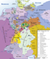
Category:Maps of the Confederation of the Rhine
Jump to navigation
Jump to search
Use the appropriate category for maps showing all or a large part of Germany. See subcategories for smaller areas:
| If the map shows | Category to use |
|---|---|
| Germany on a recently created map | Category:Maps of Germany or its subcategories |
| Germany on a map created more than 70 years ago | Category:Old maps of Germany or its subcategories |
| the history of Germany on a recently created map | Category:Maps of the history of Germany or its subcategories |
| the history of Germany on a map created more than 70 years ago | Category:Old maps of the history of Germany or its subcategories |
Subcategories
This category has the following 5 subcategories, out of 5 total.
B
H
M
Media in category "Maps of the Confederation of the Rhine"
The following 56 files are in this category, out of 56 total.
-
C. 1801-1812 Europe (treaty adjustments).jpg 1,356 × 1,099; 1.25 MB
-
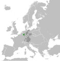
Confederation of the Rhine (1812).svg 450 × 456; 611 KB
-
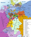
Deutschland 1812.jpg 7,413 × 6,404; 7.09 MB
-
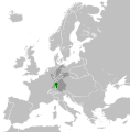
Duchy of Anhalt-Bernburg (1812).svg 450 × 456; 611 KB
-
Duchy of Anhalt-Dessau (1812).svg 450 × 456; 611 KB
-
Duchy of Anhalt-Köthen (1812).svg 450 × 456; 611 KB
-
Duchy of Mecklenburg-Schwerin (1812).svg 450 × 456; 611 KB
-
Duchy of Mecklenburg-Strelitz (1812).svg 450 × 456; 611 KB
-
Duchy of Nassau (1812).svg 450 × 456; 611 KB
-
Duchy of Saxe-Coburg-Saalfeld (1812).svg 450 × 456; 611 KB
-
Duchy of Saxe-Gotha-Altenburg (1812).svg 450 × 456; 611 KB
-
Duchy of Saxe-Hildburghausen (1812).svg 450 × 456; 611 KB
-
Duchy of Saxe-Meiningen (1812).svg 450 × 456; 611 KB
-
Duchy of Saxe-Weimar-Eisenach (1812).svg 450 × 456; 611 KB
-
Europe 1812 map ar.png 2,284 × 1,503; 1.18 MB
-
Europe 1812 map de.png 2,284 × 1,503; 1.13 MB
-
Europe 1812 map en.png 2,284 × 1,503; 1.14 MB
-
GhdBerg.png 880 × 1,209; 42 KB
-
Grand Duchy of Baden (1812).svg 450 × 456; 611 KB
-
Grand Duchy of Berg (1812).svg 450 × 456; 611 KB
-
Grand Duchy of Frankfurt (1812).svg 450 × 456; 611 KB
-
Grand Duchy of Hesse-Darmstadt (1812).svg 450 × 456; 611 KB
-
Grand Duchy of Würzburg (1812).svg 450 × 456; 611 KB
-
Grandduchy Frankfurt 1812.png 2,244 × 1,772; 1.02 MB
-
GrhFrankfurt.jpg 215 × 212; 25 KB
-
Großherzogtum Frankfurt 1811.jpg 3,692 × 5,040; 9.77 MB
-
Hannover 1807.png 991 × 759; 799 KB
-
1811 Hanseatische Dept..jpg 1,152 × 857; 145 KB
-
HessenD1806.jpg 136 × 255; 20 KB
-
Kingdom of Bavaria (1812).svg 450 × 456; 611 KB
-
Kingdom of Saxony (1812).svg 450 × 456; 611 KB
-
Kingdom of Westphalia (1812).svg 450 × 456; 611 KB
-
Kingdom of Württemberg (1812).svg 450 × 456; 611 KB
-
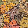
Map of Baden (1806-1945)-Kaiserstuhl (2).jpg 413 × 610; 57 KB
-
Map of Baden (1806-1945)-Kaiserstuhl (2).png 413 × 610; 142 KB
-
Map of Baden (1819-1945).png 1,954 × 2,881; 151 KB
-
Map Waldeck.png 749 × 1,034; 34 KB
-
Map-RB-1812-Grand Duchy of Berg.svg 698 × 999; 796 KB
-
Map-RB-1812-Westphalia.svg 698 × 999; 796 KB
-
Map-Rheinbund-1812.png 800 × 554; 70 KB
-
Principality of Hohenzollern-Hechingen (1812).svg 450 × 456; 611 KB
-
Principality of Hohenzollern-Sigmaringen (1812).svg 450 × 456; 611 KB
-
Principality of Isenburg (1812).svg 450 × 456; 611 KB
-
Principality of Lippe-Detmold (1812).svg 450 × 456; 611 KB
-
Principality of Reuss-Greiz (1812).svg 450 × 456; 611 KB
-
Principality of Reuss-Schleiz (1812).svg 450 × 456; 611 KB
-
Principality of Schaumburg-Lippe (1812).svg 450 × 456; 611 KB
-
Principality of Schwarzburg-Rudolstadt (1812).svg 450 × 456; 611 KB
-
Principality of Schwarzburg-Sondershausen (1812).svg 450 × 456; 611 KB
-
Principality of Waldeck-Pyrmont (1812).svg 450 × 456; 611 KB
-
Rheinbund 1806, political map.png 1,207 × 1,427; 804 KB
-
Rheinbund 1808, political map.png 1,207 × 1,426; 807 KB
-
Rheinbund 1812, political map.png 1,243 × 1,420; 737 KB
-
Rijnbond1812namen.png 1,079 × 1,384; 143 KB
-
Wuerttemberg1.png 2,079 × 2,870; 762 KB
-
إيطاليا قبل حروب التوحيد.png 3,625 × 3,543; 228 KB


