Category:Maps of the City of Westminster
Jump to navigation
Jump to search
Subcategories
This category has the following 4 subcategories, out of 4 total.
Media in category "Maps of the City of Westminster"
The following 62 files are in this category, out of 62 total.
-
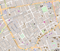
 Air Raid Damage Map - East Marylebone.jpg 1,783 × 2,229; 2.08 MB
-
 Area around Golden Square during Cholera Epidemic. Wellcome L0005796.jpg 2,900 × 3,804; 2.96 MB
-
 Baker Street 1890-2010's.png 600 × 600; 680 KB
-
 Belgravia map.png 722 × 832; 732 KB
-
 Benjamin Cole02.jpg 1,069 × 687; 227 KB
-
 Boroughs of London City of Westminster.svg 900 × 695; 42 KB
-
 Buckingham Palace Map.svg 1,129 × 833; 1.63 MB
-
 Cavendish Square and environs, 1764.jpg 309 × 333; 455 KB
-
 Chinatown london map.jpg 622 × 559; 97 KB
-
 Close of the col in westminster 1921.png 2,742 × 1,769; 73 KB
-
 Conduit Mead Estate 1794.png 569 × 737; 992 KB
-
 Drury Lane map.png 427 × 270; 130 KB
-

-
 Horwood map 1799 St Martins Westminster.jpg 625 × 485; 218 KB
-

-
 St James's Square 1799.jpg 896 × 1,073; 229 KB
-
 Location map Kensington.png 829 × 905; 831 KB
-
 Location map United Kingdom Albertopolis.png 675 × 600; 374 KB
-
 LONDON, MARYLEBONE by BARTLETT, F.A. and B.J. DAVIES.jpg 1,684 × 2,000; 1.39 MB
-
 LondonWestminster.svg 962 × 744; 19 KB
-
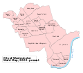
 Map City of Westminster.png 766 × 684; 362 KB
-
 Map of Covent Garden.png 811 × 833; 462 KB
-
 Map of Pimlico.png 3,793 × 3,200; 2.84 MB
-
 Map of Soho showing deaths from Cholera, 1854. Wellcome L0003055.jpg 3,047 × 3,426; 4.7 MB
-
 Map of Westminster. Wellcome M0012962.jpg 4,087 × 2,628; 3.33 MB
-
 Map Parliament Square.png 299 × 304; 57 KB
-
 Map Whitehall.png 300 × 569; 135 KB
-
 Maps Of Old London Norden Westminster.jpg 2,930 × 2,049; 1.18 MB
-
 Marylebone Station location map.png 975 × 862; 354 KB
-
 Old Towns and New Needs Fig. 3.png 1,164 × 1,162; 698 KB
-
 Oxford Street London map.png 770 × 331; 50 KB
-
 OxfordandPrincesStreetca1792.svg 337 × 241; 117 KB
-
 Paddington Met. B Ward Map 1916.svg 981 × 911; 34 KB
-
 Paddington station location map.svg 548 × 535; 1.7 MB
-
 Plan Showing the Ascertained Deaths from Cholera Wellcome L0072142.jpg 5,777 × 7,749; 6.83 MB
-
 Plan Showing the Ascertained Deaths from Cholera... Wellcome L0071633.jpg 5,347 × 7,463; 6.41 MB
-
 Precinct of the Savoy in Westminster in 1921.png 2,742 × 1,769; 73 KB
-
 Public art in the City of Westminster map.png 643 × 600; 671 KB
-
 Queen Annes Mansions 1896 OS.jpg 912 × 808; 123 KB
-
 Rolls liberty in westminster 1921.png 2,742 × 1,769; 75 KB
-
 Royal Wedding route London 2011 hu.svg 554 × 359; 50 KB
-
 Royal Wedding route London 2011 ro.svg 554 × 359; 50 KB
-
 Royal Wedding route London 2011 zh.svg 554 × 359; 50 KB
-
 Royal Wedding route London 2011.svg 554 × 359; 50 KB
-
 RSA 2014 - 1790's street plan of this area.JPG 2,480 × 2,472; 5.29 MB
-
 Soho - map 1.png 626 × 525; 422 KB
-
 St anne in westminster 1921.png 2,742 × 1,769; 76 KB
-
 St clement danes in westminster 1921.png 2,742 × 1,769; 74 KB
-
 St margaret and st john in westminster 1921.png 2,742 × 1,769; 81 KB
-
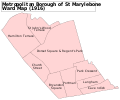 St Marylebone Met. B Ward Map 1916.svg 1,056 × 879; 30 KB
-
 St paul covent garden in westminster 1921.png 2,742 × 1,769; 76 KB
-
 Trafalgar Square Map.svg 948 × 971; 1.65 MB
-
 Westminister.jpg 803 × 794; 115 KB
-
 Westminster Civil Parish Map 1870.png 8,153 × 5,384; 2.07 MB
-
 Westminster London UK blank parish map.svg 1,357 × 1,266; 238 KB
-
 Westminster London UK blank ward map 2002 to 2022.svg 1,357 × 1,266; 258 KB
-
 Westminster London UK blank ward map 2022.svg 1,357 × 1,266; 264 KB
-
 Westminster London UK labelled ward map 2002.svg 1,286 × 1,124; 61 KB
-
 Westminster London UK location map.svg 1,357 × 1,266; 3.18 MB
-
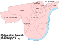 Westminster Met. B Ward Map 1916.svg 1,265 × 886; 69 KB
-
 Westminster unparished area UK locator map.svg 1,357 × 1,266; 238 KB
-
 WigmoreandWelbeckstreetca1792.svg 337 × 220; 95 KB


.jpg)


