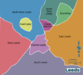
Category:Maps of the City of Leeds
Jump to navigation
Jump to search
Subcategories
This category has the following 12 subcategories, out of 12 total.
E
- Election maps of Leeds (35 F)
H
L
R
- Maps of Roundhay Park (1 F)
U
W
- Wards of the City of Leeds (36 F)
Media in category "Maps of the City of Leeds"
The following 46 files are in this category, out of 46 total.
-
Adel and Wharfedale Ward.jpg 965 × 791; 125 KB
-
African Leeds 2011 census.png 21,487 × 17,605; 14.88 MB
-
ALLERTON 11.jpg 1,299 × 924; 259 KB
-
Arab Leeds 2011 census.png 21,558 × 17,663; 14.92 MB
-
Asian Leeds 2011 census.png 21,558 × 17,663; 15.13 MB
-
Bangladeshi Leeds 2011 census.png 21,488 × 17,605; 14.69 MB
-
Battle of Leeds, 1643.png 1,030 × 823; 206 KB
-
Black Leeds 2011 census.png 21,558 × 17,663; 14.24 MB
-
Bradshaw's Railway Timetables 1839 - Leeds.jpg 1,754 × 1,323; 737 KB
-
British Leeds 2011 census.png 21,487 × 17,605; 13.5 MB
-
Buddhism Leeds 2011 census.png 21,416 × 17,547; 15.31 MB
-
Caribbean Leeds 2011 census.png 21,558 × 17,663; 15.04 MB
-
Chinese Leeds 2011 census.png 21,487 × 17,605; 15.22 MB
-
Christianity Leeds 2011 census.png 21,487 × 17,605; 14.82 MB
-
EnglandLeeds.png 200 × 247; 28 KB
-
Garforth unparished area UK locator map.svg 1,425 × 1,086; 602 KB
-
Hinduism Leeds 2011 census.png 21,487 × 17,605; 15.09 MB
-
HolbeckUrbanVillage 2014-11-20.svg 1,598 × 1,256; 1.66 MB
-
Indian Leeds 2011 census.png 21,487 × 17,605; 15.16 MB
-
Irish Leeds 2011 census.png 21,416 × 17,547; 15.38 MB
-
Leeds City Region.jpg 413 × 334; 73 KB
-
Leeds in England (special marker).svg 816 × 991; 1.32 MB
-
Leeds in England (zoom).svg 816 × 991; 821 KB
-
Leeds in England.svg 816 × 991; 1.32 MB
-
Leeds in West Yorkshire.jpg 800 × 558; 196 KB
-
Leeds map.png 1,563 × 1,302; 423 KB
-
Leeds parishes 2001.png 1,341 × 1,076; 66 KB
-
Leeds Rural 1911 with CB copy.png 857 × 641; 28 KB
-
Leeds Rural in West Riding 1911 2.png 1,938 × 1,767; 107 KB
-
Leeds Story, Leeds City Museum (11th July 2012) 006.JPG 2,176 × 2,652; 1,002 KB
-
Leeds UK location map.svg 785 × 675; 1.81 MB
-
Leeds UK locator map.svg 1,425 × 1,039; 765 KB
-
Leeds unparished area UK locator map.svg 1,425 × 1,086; 602 KB
-
Leeds urban subdivision in West Yorkshire urban area.png 2,742 × 1,769; 179 KB
-
Leeds within the West Riding in 1971.png 2,742 × 1,769; 116 KB
-
Location map United Kingdom Leeds Central.png 1,819 × 1,471; 2.86 MB
-
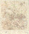
Ordnance Survey One-Inch Sheet 96 Leeds & Bradford, Published 1947.jpg 10,963 × 12,801; 19.24 MB
-
Ordnance Survey One-Inch Sheet 96 Leeds & Bradford, Published 1966.jpg 8,327 × 9,899; 12.86 MB
-
Ordnance Survey Quarter-inch sheet 11 North Midlands and Yorkshire, published 1964.jpg 9,601 × 8,904; 10.65 MB
-
OS map of St John's, Leeds, surveyed 1847.jpg 772 × 591; 112 KB
-
OSmapSeacroftSwarcliffe.jpg 1,160 × 812; 208 KB
-
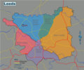
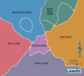
Wikivoyage Leeds district map 2 PNG.png 1,037 × 934; 106 KB
-
Wikivoyage Leeds district map PNG.png 1,037 × 934; 121 KB
-
Wikivoyage Leeds district map.svg 744 × 1,052; 434 KB
-
WYorks-Leeds.png 200 × 157; 7 KB


