Category:Maps of the Canal du Midi
Jump to navigation
Jump to search
Subcategories
This category has the following 3 subcategories, out of 3 total.
M
- Maps of Homps (Aude) (7 F)
- Maps of Mas-Saintes-Puelles (7 F)
Media in category "Maps of the Canal du Midi"
The following 24 files are in this category, out of 24 total.
-
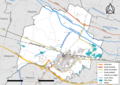 11049-Bram-Routes-Hydro.png 3,507 × 2,480; 2.34 MB
-
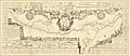 1697 map of the Canal du Midi by Jean-Baptiste Nolin.jpg 35,352 × 15,173; 109.65 MB
-
 31429-Pompertuzat-Sols.png 7,015 × 4,960; 9.15 MB
-
 Atlante Veneto Volume 1 135.jpg 9,812 × 6,564; 7 MB
-
 Canal du Midi et Lauragais OSM 2017-11-04.png 942 × 705; 887 KB
-
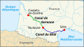
 Canal du Midi map-ca.svg 1,047 × 689; 395 KB
-
 Canal du Midi map-de.svg 1,047 × 689; 551 KB
-
 Canal du Midi map-el.svg 1,048 × 582; 291 KB
-
 Canal du Midi map-eo.svg 1,048 × 582; 289 KB
-
 Canal du Midi map-es.svg 1,117 × 735; 308 KB
-
 Canal du Midi map-fr mirrored.svg 1,047 × 689; 395 KB
-
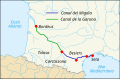
 Canal du Midi map-fr.svg 1,048 × 582; 295 KB
-
 Canal du Midi map-HE.svg 1,047 × 689; 401 KB
-
 Canal du Midi map-hu.svg 1,048 × 582; 300 KB
-
 Canal du Midi.png 800 × 526; 132 KB
-
 CanalDuMidi map.jpg 832 × 641; 369 KB
-
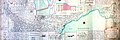
 Carte canal royal - 18?? - btv1b53029748t.jpg 9,754 × 5,034; 6.94 MB
-
 Carte du canal du midi.jpg 3,861 × 2,894; 3.47 MB
-
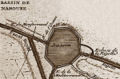 CdM - Bassin de Naurouze.jpg 300 × 198; 65 KB
-
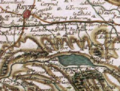 France Revel Saint-Ferreol.png 312 × 236; 188 KB
-
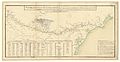
 Le Canal Royal de Languedoc .jpg 2,602 × 1,764; 1.03 MB
-

-
 Plan canal Midi.jpg 12,000 × 4,000; 2.46 MB
-
 Profil canal du midi.png 978 × 451; 20 KB


