Category:Maps of the Cairngorms
Appearance
Media in category "Maps of the Cairngorms"
The following 9 files are in this category, out of 9 total.
-
Cairngorm relief map for 1971 disaster.svg 712 × 811; 904 KB
-
Cairngorms National Park map.svg 1,425 × 1,200; 1.45 MB
-
Cairngorms National Park UK location map.svg 1,425 × 1,173; 1.35 MB
-
Cairngorms National Park UK relief location map.png 2,001 × 1,646; 3.98 MB
-
Cairngorms-sketch-map.jpg 800 × 600; 78 KB
-
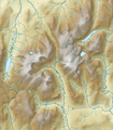
Central Cairngorms UK relief map.png 791 × 901; 278 KB
-
Lairig-ghru-sketch-map.jpg 600 × 881; 51 KB
-
Luibeg Map.png 494 × 306; 174 KB
-
Ordnance Survey One-Inch Tourist Map of the Cairngorms Published 1964.jpg 9,907 × 12,430; 14.98 MB


