Category:Maps of the Byzantine Empire in 565
Jump to navigation
Jump to search
This category contains maps depicting the Byzantine Empire at its greatest extent during Late Antiquity, at the death of Emperor Justinian I in 565 AD.
Media in category "Maps of the Byzantine Empire in 565"
The following 50 files are in this category, out of 50 total.
-
4KJUSTINIAN.png 3,840 × 2,160; 524 KB
-
565 CE, Europe.svg 512 × 438; 1.5 MB
-
Area at the time of Justinian I's death in the Byzantine Empire.png 2,500 × 1,431; 519 KB
-
BizancjumVI.png 733 × 362; 46 KB
-
Bizánc550.PNG 800 × 370; 29 KB
-
Bysantin valtakunta keisari Justinianuksen aikana.png 800 × 370; 24 KB
-
Byzanc za Justiniána.png 893 × 506; 263 KB
-
Byzanc-Justinián.png 2,000 × 1,100; 2.38 MB
-
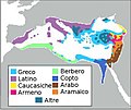
ByzantEmpLang VI s-IT.jpg 500 × 419; 66 KB
-
ByzantEmpLang VI s.jpg 432 × 362; 56 KB
-
Byzantime Empire around 565 AD.svg 2,080 × 1,100; 89 KB
-
Byzantine Empire.PNG 280 × 200; 11 KB
-
Byzantine Empire.png 500 × 231; 14 KB
-
Byzantine mints of Justinian I.png 1,176 × 538; 82 KB
-
Byzantine Spain - 565-586ru.svg 798 × 444; 293 KB
-
ByzantineEmpireGE.PNG 1,084 × 705; 33 KB
-
Byzantinemax.png 800 × 370; 29 KB
-
Eastern Roman Empire 565 AD.png 800 × 385; 101 KB
-
Eastern Roman Empire, Justinian the Great period(AD550).jpg 2,100 × 1,392; 178 KB
-
EasternRomanEmpire.png 250 × 175; 7 KB
-
Empèri Bizantin - Periòde de Justinian 2.png 1,018 × 574; 250 KB
-
Empèri Bizantin - Rèine de Justinian.png 1,018 × 574; 250 KB
-
España bizantina 5-fr.svg 798 × 444; 299 KB
-
España bizantina 5-hu.svg 3,731 × 2,000; 527 KB
-
España bizantina 5.svg 3,731 × 2,000; 917 KB
-
España bizantina-pt.svg 512 × 274; 142 KB
-
Europe at the death of Justinian I in 565.jpg 2,747 × 1,966; 4.19 MB
-
Europe-In-555AD.png 2,862 × 1,670; 2.85 MB
-
Exarchate of Africa.png 800 × 378; 15 KB
-
Exarchate-Africa.png 1,810 × 871; 256 KB
-
Exarchate-Ravenna.png 1,810 × 871; 256 KB
-
Expansion del Imperio Bizantino.jpg 2,432 × 1,873; 531 KB
-
ImperiBizantí550.png 800 × 370; 23 KB
-
Justinian Byzanz-BLANCO.png 2,000 × 1,100; 685 KB
-
Justinian Byzanz.png 2,000 × 1,100; 836 KB
-
Justinian550AD.png 694 × 396; 13 KB
-
Justinien 527-565.svg 1,810 × 871; 577 KB
-
Lingue impero bizantino 565.JPG 906 × 409; 86 KB
-
LocationByzantineEmpire.png 1,084 × 705; 29 KB
-
LocationByzantineEmpire.svg 1,084 × 705; 181 KB
-
Major powers in Eurasia around 555AD.png 19,000 × 9,439; 8.64 MB
-
NE 565ad.jpg 1,477 × 973; 226 KB
-
Roman-Empire 565ad.jpg 1,287 × 875; 1.23 MB
-
Spruner-Menke Handatlas 1880 Karte 02.jpg 10,385 × 8,785; 17.91 MB
-
Spruner-Menke Handatlas 1880 Karte 76.jpg 3,439 × 2,963; 1.03 MB
-
The Byzantine State under Justinian I-es.svg 1,873 × 935; 713 KB
-
The Byzantine State under Justinian I-pt.svg 1,873 × 935; 671 KB
-
The Byzantine State under Justinian I-sr.svg 1,810 × 871; 806 KB


