Category:Maps of the Bronze Age in China
Jump to navigation
Jump to search
Subcategories
This category has the following 2 subcategories, out of 2 total.
M
- Maps of Erlitou culture (6 F)
- Maps of the Shang Dynasty (20 F)
Media in category "Maps of the Bronze Age in China"
The following 21 files are in this category, out of 21 total.
-
Chariot spread.png 400 × 231; 154 KB
-
City of Xiutu.png 1,898 × 1,320; 4.69 MB
-
Continental Asia in 2000 BCE.png 2,396 × 1,376; 5.1 MB
-
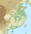
Feijiahe culture map.svg 920 × 1,006; 467 KB
-
From Neolithic to Bronze Age in China.jpg 1,500 × 1,005; 1.3 MB
-
Historicalcapitalsofchina ancient.png 1,080 × 1,150; 176 KB
-
Influences on Chinese metallurgy.png 2,230 × 1,348; 7.01 MB
-
Late Neolithic cultures in China. Majiayao main sites.jpg 2,500 × 1,675; 1.64 MB
-
Late Neolithic cultures in China.jpg 2,500 × 1,675; 1,009 KB
-
Lintao location, and Great Wall of China.png 1,898 × 1,320; 5.11 MB
-
Neolithic cultures area of china.png 1,200 × 804; 1.65 MB
-
Neolithicum 3000-2000.png 725 × 608; 45 KB
-
North-east early bronze age sites map.png 1,199 × 1,024; 1.41 MB
-
Qijia map.svg 920 × 1,006; 461 KB
-
Shajing culture map.png 2,073 × 1,365; 5.63 MB
-
Shang-Sanxingdui Sites.png 816 × 1,056; 982 KB
-
Siwa culture. Location of the Zhanqi site.png 2,220 × 1,424; 2.95 MB
-
Xichengyi sites.png 4,562 × 3,108; 7.64 MB
-
Yueshi map.svg 920 × 1,006; 461 KB
-
Yueshi-North-east early bronze age sites map.png 1,199 × 1,024; 1.53 MB
-
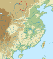
Zhukaigou map.svg 920 × 1,006; 461 KB


