Category:Maps of the British Isles by Gerardus Mercator
Jump to navigation
Jump to search
Subcategories
This category has the following 5 subcategories, out of 5 total.
M
Media in category "Maps of the British Isles by Gerardus Mercator"
The following 15 files are in this category, out of 15 total.
-
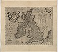
Anglia, Scotia et Hibernia.jpg 2,000 × 1,597; 1.61 MB
-
Atlas Cosmographicae (Mercator) 047 (cropped).jpg 2,581 × 2,118; 2.08 MB
-
Atlas Cosmographicae (Mercator) 047.jpg 2,443 × 1,962; 1.82 MB
-
Anglia, Scotia et Hibernia - Per Gerardum Mercatorem - btv1b53056582x (1 of 2).jpg 5,952 × 5,328; 5.24 MB
-
Atlas Minor Gerardi Mercatoris 1609 (106752904).jpg 5,778 × 4,532; 5.15 MB
-
Atlas 1623 77 Anglia Scotia Hibernia.jpg 7,232 × 5,656; 14.7 MB
-
Cosmographicae (10534043).jpg 12,036 × 8,272; 26.94 MB
-
Anglia Scotia et Hibernia (Grande-Bretagne).jpg 8,996 × 7,739; 9.11 MB
-
Atlas ou Representation du Monde Universel t. 1. 1633 (109103623).jpg 16,950 × 11,908; 34.78 MB


