Category:Maps of the Baltic states
Jump to navigation
Jump to search
Subcategories
This category has the following 3 subcategories, out of 3 total.
Media in category "Maps of the Baltic states"
The following 65 files are in this category, out of 65 total.
-
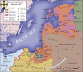
Livonia in 1534 (English).png 475 × 486; 65 KB
-
Vana-Liivimaa-es.svg 864 × 900; 2.55 MB
-
17cenBaltic.jpg 1,434 × 1,402; 1.07 MB
-
Gubernie zachodnie krolestwo polskie 1902.jpg 2,500 × 3,247; 2.21 MB
-
Baltian maat.png 218 × 311; 9 KB
-
Baltic Air Policing map (names in Polish).png 492 × 691; 82 KB
-
Baltic countries hu.png 685 × 566; 30 KB
-
Baltic countries.png 932 × 566; 37 KB
-
Baltic Entente.png 900 × 912; 129 KB
-
Baltic Map.jpg 720 × 960; 116 KB
-
Baltic regions by GDP per capita.png 3,150 × 1,864; 560 KB
-
Baltic States 1940 Locator Map.png 1,200 × 1,804; 348 KB
-
Baltic States 2.svg 1,401 × 1,198; 1.87 MB
-
Baltic states in the first half of the 16th century - es.svg 1,256 × 1,745; 893 KB
-
Baltic states in the first half of the 16th century - ru.svg 1,256 × 1,745; 948 KB
-
Baltic states municipalities.PNG 1,832 × 2,670; 368 KB
-
Baltic states regions map.png 1,704 × 1,363; 654 KB
-
Baltic States.png 1,218 × 1,245; 31 KB
-
Baltic states.svg 2,045 × 1,720; 2.67 MB
-
Baltics (ru).png 1,704 × 1,363; 659 KB
-
Baltics (uk).png 1,704 × 1,363; 647 KB
-
Baltics.svg 1,280 × 720; 2.5 MB
-
Baltikum.png 1,228 × 1,737; 748 KB
-
Baltikumrelief.png 3,536 × 2,504; 12 MB
-
Brockhaus' Konversations-Lexikon (1892) (14784551785).jpg 2,544 × 1,675; 888 KB
-
Det baltiska hertigdömet.png 382 × 309; 16 KB
-
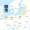
E11 Overview map.jpg 1,182 × 1,182; 527 KB
-
Estados Balticos en la Actualidad.png 250 × 348; 97 KB
-
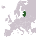
Estonia, Latvia & Lithuania in Northern Europe.png 1,121 × 869; 65 KB
-
Estonia-latvia-lithuania-in-northern-europe.png 626 × 750; 115 KB
-
EU NUTS 2 Baltic states.svg 850 × 600; 2.1 MB
-
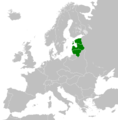
Europe location Baltic states.png 450 × 422; 13 KB
-
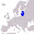
LocationBalticStatesInEurope.png 415 × 422; 15 KB
-
LocationPaysBalte.png 250 × 115; 7 KB
-
Map of non recogntion of the Baltic states.png 2,664 × 1,468; 106 KB
-
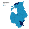
Map of NUTS3 regions of the Baltic States by Human Development Index.png 3,108 × 3,110; 396 KB
-
Map of Poland and Lithuania in 1600-es.svg 843 × 638; 129 KB
-
Map of Poland and Lithuania in 1600.svg 845 × 639; 48 KB
-
Map of the Swedish language in and around the Baltic Sea (typ2).png 4,128 × 7,959; 406 KB
-
NB8 coloured as one country.png 1,024 × 1,024; 289 KB
-
Partition of the Livonian Order - es.svg 930 × 1,245; 335 KB
-
Partition of the Livonian Order - ru.svg 930 × 1,245; 390 KB
-
PAT - Baltic States.gif 1,500 × 1,800; 617 KB
-
PaysBaltes-Langues.jpg 269 × 362; 119 KB
-
Pribaltika 1952-53.png 357 × 431; 31 KB
-
Puola-Liettua.png 476 × 374; 10 KB
-
Rada Państw Morza Bałtyckiego - mapa.png 6,460 × 3,403; 2.61 MB
-
RailBaltica.jpg 1,459 × 1,774; 593 KB
-
Ruotsin valtakunta (1560–1815).png 3,672 × 4,708; 272 KB
-
Ruotsin valtakunta (1560–1815).svg 433 × 531; 142 KB
-
Soviet Union disputes 1948-04-07 to 1952-04-28.png 2,000 × 1,210; 311 KB
-
Subdivisions of baltic states.svg 1,832 × 2,670; 374 KB
-
Suwalki Gap-de-cropped.png 640 × 480; 96 KB
-
Suwalki Gap-et.png 1,711 × 1,700; 278 KB
-
Territorial-changes-of-Poland-1635-2009-improved.gif 550 × 400; 4.11 MB
-
Teutonic Order 1466-es.svg 1,210 × 1,053; 1.79 MB
-
Teutonic Order 1466.png 1,200 × 1,043; 744 KB
-
The Baltic Republics - DPLA - 695bd5131aca6479cf77614e6d8aed6a.jpg 2,554 × 3,284; 5.26 MB
-
The Baltic States - DPLA - 1b4effa4cec1c4794c9f2204f839b284.jpg 2,550 × 3,276; 4.92 MB
-
Каралеўства Швецыя (1560–1815).svg 433 × 531; 143 KB
-
Прибалтийский экономический район.png 2,500 × 2,500; 3.6 MB
-
波罗的海国家概图.png 1,655 × 2,301; 1 MB


