Category:Maps of the Bakerloo line
Jump to navigation
Jump to search
Subcategories
This category has only the following subcategory.
Media in category "Maps of the Bakerloo line"
The following 31 files are in this category, out of 31 total.
-
Baker Street & Waterloo Railway 1896.png 680 × 400; 20 KB
-
Baker Street & Waterloo Railway 1896.svg 370 × 220; 10 KB
-
Baker Street & Waterloo Railway 1896JP.png 680 × 400; 27 KB
-
Baker Street & Waterloo Railway 1898.png 1,050 × 740; 44 KB
-
Baker Street & Waterloo Railway 1898.svg 550 × 400; 21 KB
-
Baker Street & Waterloo Railway 1898JP.png 1,050 × 740; 56 KB
-
Baker Street & Waterloo Railway 1899.png 780 × 480; 28 KB
-
Baker Street & Waterloo Railway 1899JP.png 780 × 480; 38 KB
-
Baker Street & Waterloo Railway 1900.png 730 × 480; 26 KB
-
Baker Street & Waterloo Railway 1900JP.png 730 × 480; 36 KB
-
Baker Street & Waterloo Railway 1904.png 780 × 480; 29 KB
-
Baker Street & Waterloo Railway 1904JP.png 784 × 480; 40 KB
-
Baker Street & Waterloo Railway 1906.png 780 × 500; 33 KB
-
Baker Street & Waterloo Railway 1906JP.png 784 × 500; 45 KB
-
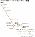
Baker Street & Waterloo Railway 1908.png 950 × 1,000; 49 KB
-
Baker Street & Waterloo Railway 1908JP.png 950 × 1,000; 66 KB
-
Baker Street & Waterloo Railway.png 1,650 × 1,500; 86 KB
-
Baker Street & Waterloo Railway1893.png 680 × 400; 18 KB
-
Baker Street & Waterloo Railway1893JP.png 784 × 400; 27 KB
-
Baker Street & Waterloo RailwayJP.png 1,650 × 1,500; 143 KB
-
Bakerloo line flag box.png 694 × 124; 7 KB
-
Bakerloo Line- Anys.jpg 782 × 533; 28 KB
-
Bakerloo Line.png 1,280 × 853; 30 KB
-
Bakerloo Line.svg 900 × 600; 21 KB
-
Bakerloo map 1908.jpg 770 × 512; 180 KB
-
Bakerloo.png 454 × 875; 13 KB
-
CharingCrossStrandStations.png 1,077 × 871; 1.26 MB
-
London flag boxes - Underground Bakerloo line.svg 480 × 60; 3 KB
-
London Underground proposed Bakerloo line extension map.svg 993 × 593; 145 KB
-
Willesden Junction map with Old Oak Common.png 1,467 × 903; 1.15 MB
-
Willesden junction map.png 1,467 × 903; 1.29 MB


