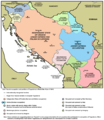
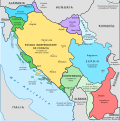
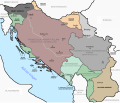
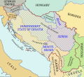
Category:Maps of the Axis occupation of Yugoslavia
Jump to navigation
Jump to search
Subcategories
This category has only the following subcategory.
Media in category "Maps of the Axis occupation of Yugoslavia"
The following 42 files are in this category, out of 42 total.
-
AtlBalk1942.jpg 318 × 327; 141 KB
-
Fascist occupation of yugoslavia-sr.png 1,076 × 1,188; 164 KB
-
Fascist occupation of yugoslavia.png 1,076 × 1,239; 172 KB
-
Occupation de la Yougoslavie par l'Axe, 1941-43-es.svg 1,504 × 1,509; 681 KB
-
Occupation de la Yougoslavie par l'Axe, 1941-43.svg 1,494 × 2,051; 193 KB
-
Axis occupation of Yugoslavia, 1941-43.png 1,076 × 1,190; 170 KB
-
Axis occupation of Yugoslavia 1941-43 Hebrew.png 542 × 599; 136 KB
-
Axis occupation of Yugoslavia, 1943-44-es.svg 1,504 × 1,509; 699 KB
-
Axis occupation of Yugoslavia, 1943-44.png 1,076 × 1,190; 172 KB
-
Occupation de la Yougoslavie par l'Axe, 1943-44.png 1,076 × 1,190; 167 KB
-
Axis occupation of Yugoslavia 1941-43 hu.svg 1,047 × 894; 87 KB
-
Axis occupation of Yugoslavia 1941-43 legend.png 1,047 × 1,152; 179 KB
-
Axis occupation of Yugoslavia 1941-43.png 1,047 × 894; 50 KB
-
Axis occupation of Yugoslavia 1943-44.png 1,047 × 894; 90 KB
-
1941-1943 Axis occupation of Yugoslavia map - en.svg 1,613 × 1,471; 2.89 MB
-
1941-1943 Axis occupation of Yugoslavia map - es.svg 1,613 × 1,471; 690 KB
-
1941-1943 Axis occupation of Yugoslavia map - hr.svg 1,613 × 1,471; 2.89 MB
-
1941-1943 Axis occupation of Yugoslavia map - ru.svg 1,613 × 1,471; 2.89 MB
-
1941-1943 Axis occupation of Yugoslavia map - sr.svg 1,613 × 1,471; 2.89 MB
-
1941-1943 Axis occupation of Yugoslavia map-hu.svg 1,613 × 1,471; 415 KB
-
1941-1943 Axis occupation of Yugoslavia map.svg 1,613 × 1,471; 2.42 MB
-
Balcans 1942.png 651 × 698; 86 KB
-
Balkans Animation 1800-2008.gif 744 × 618; 542 KB
-
Fascist occupation of yugoslavia hu.png 1,255 × 1,446; 604 KB
-
Hungarian Occupied Yugoslavia 1941 44.png 1,032 × 659; 249 KB
-
Jugoslavija u drugom svetskom ratu.png 5,000 × 4,267; 1.03 MB
-
Map of partition of Yugoslavia.jpg 1,347 × 798; 504 KB
-
Map of the Axis occupation of Yugoslavia-es.svg 1,672 × 1,509; 559 KB
-
Map of the Axis occupation of Yugoslavia.svg 1,672 × 1,509; 853 KB
-
Ocupação da Iugoslávia pelas forças do eixo 1941-1943.svg 1,505 × 2,054; 176 KB
-
Okupacija Jugoslavije 1941-1945.jpg 3,462 × 3,138; 1.96 MB
-
Okupirana Jugoslavija.jpg 2,999 × 2,498; 2.3 MB
-
Western Balkans 1942-2008-hu.svg 1,222 × 930; 248 KB
-
Western Balkans 1942.2008 (ru).png 900 × 675; 338 KB
-
Western Balkans 1942.2008 (ru).svg 1,200 × 900; 298 KB
-
Western Balkans 1942.2008 ca.svg 1,222 × 930; 246 KB
-
Western Balkans 1942.2008 ES.svg 1,222 × 930; 543 KB
-
Western Balkans 1942.2008 sr.svg 1,200 × 900; 298 KB
-
Western Balkans 1942.2008.png 800 × 600; 292 KB
-
WWII Occupied Yugoslavia Locator Map.png 1,210 × 1,101; 255 KB
-
Yugoslavia 1941 bs.PNG 448 × 248; 68 KB
-
Yugoslavia 1941.png 448 × 248; 68 KB


