Category:Maps of the Anglo-Mysore wars
Jump to navigation
Jump to search
Media in category "Maps of the Anglo-Mysore wars"
The following 15 files are in this category, out of 15 total.
-
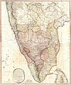
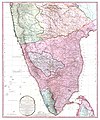
1793 Faden Wall Map of India - Geographicus - India-faden-1793.jpg 6,000 × 7,229; 9.83 MB
-
1800 Faden Rennell Wall Map of India - Geographicus - India-faden-1795.jpg 6,000 × 7,353; 10.85 MB
-
1800 Map of Peninsular India-1795.jpg 5,936 × 7,137; 50.39 MB
-
Anglo-Mysore War 1 and 2.marathi.png 419 × 556; 75 KB
-
Anglo-Mysore War 1 and 2.png 419 × 556; 74 KB
-
Anglo-Mysore War 3.marathi.png 419 × 556; 84 KB
-
Anglo-Mysore War 3.png 419 × 556; 78 KB
-
Anglo-Mysore War 4.marathi.png 419 × 556; 88 KB
-
Anglo-Mysore War 4.png 419 × 556; 92 KB
-
Anglo-Mysore Wars 3.svg 420 × 556; 82 KB
-
Plan de la bataille terrestre de Gondelour 1783.jpg 1,175 × 874; 691 KB
-
Plan of Seringapatam and its environs.jpg 1,896 × 1,410; 326 KB
-
Plan of Seringapatam.jpg 2,688 × 2,058; 2.72 MB
-
Sketch plan of the attack on Mysore.jpg 406 × 712; 111 KB
-
South India Map 1794.jpg 3,400 × 4,608; 2.59 MB


