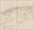
Category:Maps of the Algerian railway network in 1930
Jump to navigation
Jump to search
Media in category "Maps of the Algerian railway network in 1930"
The following 6 files are in this category, out of 6 total.
-
Carte du réseau PLM algérien, 1930.jpg 1,678 × 1,469; 499 KB
-
Chemins de Fer de Paris à Lyon et à la Méditerranée (Réseau Algérien) - 1930.png 5,566 × 4,639; 42.43 MB
-
Map of the Algerian Railway Network (1930) - ar.png 4,800 × 2,800; 8.63 MB
-
Map of the Algerian Railway Network (1930) - blank.png 4,800 × 3,500; 1.86 MB
-
Map of the Algerian Railway Network (1930) - fr.png 4,800 × 2,800; 2.65 MB
-
Réseau ferré algérien en 1930.png 4,800 × 3,600; 1.22 MB


