Category:Maps of the African Union
Jump to navigation
Jump to search
Subcategories
This category has the following 2 subcategories, out of 2 total.
*
Media in category "Maps of the African Union"
The following 22 files are in this category, out of 22 total.
-
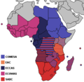
Active RECs of the AEC.png 347 × 335; 16 KB
-
African Court on Human and Peoples' Rights.png 347 × 337; 9 KB
-
African Union (orthographic projection) 2017-.png 541 × 541; 84 KB
-
African Union (orthographic projection).png 541 × 541; 123 KB
-
African Union 2023.png 549 × 549; 108 KB
-
African Union 31-08-2023.png 549 × 549; 102 KB
-
African Union countries that have not recognised South Sudan map.png 354 × 405; 10 KB
-
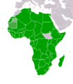
African Union map new.png 354 × 405; 10 KB
-
African Union member states by form of government.png 338 × 332; 11 KB
-
African Union member states by freedom.png 314 × 329; 11 KB
-
African Union member states by head of state.png 345 × 329; 11 KB
-
African Union member states by internal structure.png 349 × 334; 13 KB
-
African Union member states by number of houses.png 349 × 334; 13 KB
-
AfricanUnion-map.png 354 × 405; 10 KB
-
Freedom House electoral democracies in the African Union 2006.png 340 × 350; 11 KB
-
LocationAfricanUnion.png 250 × 115; 15 KB
-
Major Military Alliances2.png 2,000 × 880; 122 KB
-
RECs of the AEC without CEN-SAD & COMESA.png 347 × 335; 13 KB
-
RECs of the AEC.png 347 × 335; 17 KB
-
Regions of the African Union.png 600 × 600; 87 KB
-
AfricanUnion-map2.png 354 × 405; 13 KB
-
大陆组织地图.png 1,357 × 628; 81 KB


