Category:Maps of the İzmir Metro
Jump to navigation
Jump to search

- Provincial centers of Turkey
| NO WIKIDATA ID FOUND! Search for Maps of the İzmir Metro on Wikidata | |
| Upload media |
Media in category "Maps of the İzmir Metro"
The following 14 files are in this category, out of 14 total.
-
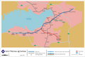 Extensions metro Izmir.png 4,082 × 2,719; 746 KB
-
 Izmir Metro Map.png 2,595 × 705; 143 KB
-
 Izmir metro.svg 767 × 1,162; 23 KB
-
 IzmirMetrosu3013.jpg 6,650 × 1,216; 402 KB
-
 Map of the İzmir Metro line M1.svg 512 × 48; 15 KB
-
 Metro Izmir map (2000).png 2,780 × 460; 248 KB
-
 Metro Izmir map (final extension).png 2,780 × 460; 256 KB
-
 Metro Izmir network map (future extension 1).png 2,780 × 460; 246 KB
-
 Metro Izmir network map (future extension 2).png 2,780 × 460; 248 KB
-
 Metro Izmir network map (future extension 3).png 2,780 × 460; 250 KB
-
 Metro Izmir network map with IZBAN.png 2,780 × 460; 250 KB
-
 Metro Izmir network map.png 2,780 × 460; 247 KB
-
 Metro Line Izmir.png 2,529 × 687; 133 KB
-
 İzmir Railway Systems Network Map.svg 512 × 512; 75 KB


.png)
.png)
.png)
.png)
.png)