Category:Maps of territories in the Upper Rhenish Circle
Jump to navigation
Jump to search
Subcategories
This category has the following 5 subcategories, out of 5 total.
*
B
H
Media in category "Maps of territories in the Upper Rhenish Circle"
The following 22 files are in this category, out of 22 total.
-
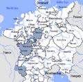
Upper Rhenish Circle-2005-10-15-en.png 727 × 714; 67 KB
-
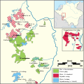
Locator Upper-Rhenisch Circle.svg 1,165 × 1,140; 193 KB
-
Upper Rhenish Circle-hu.PNG 610 × 599; 209 KB
-
1450 Sayn Map.jpg 349 × 262; 32 KB
-
Burggrafschaft Friedberg.png 1,387 × 660; 269 KB
-
C. 1540 Lotharingia.jpg 604 × 580; 446 KB
-
Elzas in de middeleeuwen.png 234 × 339; 41 KB
-
Isenburg 1400.png 306 × 266; 257 KB
-
Karte Grenzen Schaumberg Region 1766-1789.jpg 5,154 × 5,934; 11.69 MB
-
Landgraf-Carl-Kanal.png 3,088 × 3,025; 1.07 MB
-
Map of Pfalz-Zweibrücken (1700)-de.svg 902 × 902; 225 KB
-
Map of Pfalz-Zweibrücken (1700)-hu.svg 902 × 902; 226 KB
-
Map of Pfalz-Zweibrücken (1700)-NL.svg 902 × 902; 225 KB
-
Map of the Imperial Circles (1560)-NL cropped.svg 613 × 558; 341 KB
-
NassauWeilburg1789.png 512 × 844; 47 KB
-
Reichksabtei Prüm.png 411 × 399; 95 KB
-
Rheingraf 1400.png 257 × 193; 156 KB
-
Obersalm 1400.png 340 × 258; 278 KB
-
Fürstbistum Speyer.png 420 × 280; 139 KB
-
Trier-Sponheim 1648.png 365 × 331; 74 KB
-
Wied 1400.PNG 231 × 174; 115 KB
-
Zweibruecken 1400.png 281 × 211; 187 KB


