Category:Maps of telegraph lines
Jump to navigation
Jump to search
Subcategories
This category has the following 2 subcategories, out of 2 total.
Media in category "Maps of telegraph lines"
The following 57 files are in this category, out of 57 total.
-
1853 russisches netz.jpg 390 × 500; 29 KB
-
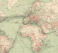
1891 Telegraph Lines.jpg 956 × 600; 232 KB
-
1910s Cable Map of the World by the British War Office.jpg 12,184 × 7,864; 10.39 MB
-
1917 map - Telegraphen-Verbindungen in der asiatischen Türkei.tif 10,861 × 7,479; 24.56 MB
-
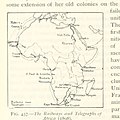
642 of 'The International Geography. ... Edited by H. R. Mill' (11169805154).jpg 393 × 1,086; 135 KB
-
8ème Armée. Schéma des communications télégraphiques - btv1b53209923f.jpg 9,847 × 9,144; 11.28 MB
-
A map showing some of the chief telegraph stations in Britai Wellcome V0041156.jpg 3,136 × 2,892; 4.71 MB
-
Admiralty Chart No 3778 Telegraph chart of the world, Published 1928.tiff 7,267 × 10,473; 217.78 MB
-
Brazil.jpg 3,964 × 5,900; 4.77 MB
-
Carte générale des grandes communications télégraphiques du monde.jpg 7,265 × 5,119; 34.73 MB
-
Eisenbahnen- und Telegraphendichte der Erde um 1900.jpg 1,200 × 858; 785 KB
-
Eisenbahnen-Telegrafen-Mitteleuropa-um1850.jpg 1,843 × 1,418; 1.54 MB
-
General map of telegraph lines between Europe, India, Australia, and China. RMG F0302.tiff 7,199 × 5,329; 109.76 MB
-
Indienueberblick 3 91.jpg 2,696 × 1,775; 1.2 MB
-
Map - South Aust. Communications to Europe.jpg 760 × 570; 101 KB
-
Map NT - Line of Telegraph 1919.jpg 384 × 760; 67 KB
-
Map of telegraph lines - Saigon Central Post Office - Ho Chi Minh City, Vietnam - DSC01156.JPG 5,472 × 3,648; 10.72 MB
-
Maps LOC mmorse000105-3.jpg 6,960 × 5,000; 4.37 MB
-
Maps LOC mmorse000105-3.tif 6,969 × 5,000; 99.71 MB
-
Maps LOC mmorse000105-4.jpg 3,967 × 2,792; 2.04 MB
-
Maps LOC mmorse000105-4.tif 3,967 × 2,792; 31.69 MB
-
Maps LOC mmorse000105-5.jpg 11,180 × 7,590; 12.38 MB
-
Maps LOC mmorse000105-5.tif 11,180 × 7,590; 242.78 MB
-
Maps LOC mmorse000105-6.jpg 8,828 × 8,180; 10.44 MB
-
Mohun telegraph expedition.JPG 734 × 766; 199 KB
-
Net of Longitude.jpg 1,682 × 1,161; 535 KB
-
Notes of lessons on the Herbartian method (based on Herbart's plan) (1902) (14803735753).jpg 1,624 × 2,744; 1.33 MB
-
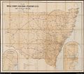
NSW Telegraph & Mail Routes-Oct 1885.jpg 760 × 534; 104 KB
-
NSW Telegraph and Mail Routes 1900.jpg 1,000 × 886; 267 KB
-
Nyaya za telegrafu mnamo 1901.png 2,533 × 2,321; 13.71 MB
-
Our country and its resources; (1917) (14596917697).jpg 2,576 × 1,752; 500 KB
-
Pacific Telegraph Route - map, 1862.jpg 4,325 × 750; 2.58 MB
-
Porthcurno cables.jpg 300 × 303; 48 KB
-
Rijkstelegraaf bestaat honderd jaar Weeknummer, 52-31 - Open Beelden - 22071.ogv 2 min 0 s, 384 × 288; 16.04 MB
-
Telégrafo Submarino Brasileiro.tif 10,031 × 6,803; 109.22 MB
-
Txu-oclc-10552568-nh45-16.jpg 5,000 × 3,794; 4.32 MB
-
מפת ה PEF (סביבות 1880) קווי הטלגרף הוליכים ליפו מדרום.png 960 × 720; 1.09 MB


