Category:Maps of subdivisions of Rwanda
Jump to navigation
Jump to search
Countries of Africa: Algeria · Angola · Benin · Botswana · Burkina Faso · Burundi · Cameroon · Cape Verde · Central African Republic · Chad · Comoros · Democratic Republic of the Congo · Republic of the Congo · Djibouti · Egypt‡ · Equatorial Guinea · Eritrea · Eswatini · Ethiopia · Gabon · The Gambia · Ghana · Guinea · Guinea-Bissau · Ivory Coast · Kenya · Lesotho · Liberia · Libya · Madagascar · Malawi · Morocco · Mozambique · Namibia · Niger · Rwanda · Sierra Leone · Somalia · South Africa · South Sudan · Sudan · Tanzania · Togo · Uganda · Zambia · Zimbabwe
Limited recognition: Ambazonia
‡: partly located in Africa
Limited recognition: Ambazonia
‡: partly located in Africa
Subcategories
This category has the following 5 subcategories, out of 5 total.
Media in category "Maps of subdivisions of Rwanda"
The following 19 files are in this category, out of 19 total.
-
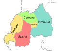
Provinces of Rwanda mk.svg 682 × 598; 97 KB
-
Provinces of Rwanda ru.svg 682 × 598; 150 KB
-
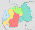
Provinces of Rwanda.svg 682 × 598; 146 KB
-
Ruanda Antiga e Nova Divisão.PNG 922 × 451; 51 KB
-
Ruanda deutsch UNO-Karte mit Neuer Gliederung.jpg 2,049 × 1,524; 851 KB
-
Ruanda deutsch UNO-Karte.jpg 2,049 × 1,523; 881 KB
-
Rwanda 3717 r11.1 sep18.jpg 2,563 × 1,957; 1.9 MB
-
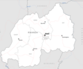
Rwanda Base Map.png 832 × 701; 143 KB
-
Rwanda Districts Map.jpg 1,500 × 1,084; 147 KB
-
Rwanda districts.png 1,025 × 595; 14 KB
-
Rwanda EastProvDists.png 1,025 × 595; 18 KB
-
Rwanda KigaliProvDists.png 1,025 × 595; 15 KB
-
Rwanda NorthProvDists.png 1,025 × 595; 16 KB
-
Rwanda Provinces 2006.png 450 × 398; 35 KB
-
Rwanda Sectors.PNG 658 × 526; 42 KB
-
Rwanda SouthProvDists.png 1,025 × 595; 17 KB
-
Rwanda WestProvDists.png 1,025 × 595; 17 KB
-
RwandaDists.png 651 × 507; 29 KB
-
RwandaGeoProvinces.png 327 × 317; 42 KB


