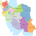
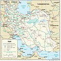
Category:Maps of subdivisions of Iran
Jump to navigation
Jump to search
Subcategories
This category has the following 4 subcategories, out of 4 total.
C
N
P
Media in category "Maps of subdivisions of Iran"
The following 17 files are in this category, out of 17 total.
-
2سەفاخانە.jpg 9,354 × 6,612; 2.46 MB
-
2کشاور.jpg 6,612 × 9,354; 2.53 MB
-
East Azerbaijan 1960.png 1,644 × 1,856; 401 KB
-
Iran Administrative Division (Eyalat and Velayat) map 1911 (1290 SH).png 1,281 × 878; 26 KB
-
Iran Physiography.jpg 2,000 × 2,001; 1.68 MB
-
Iran provinces and counties 1956 English.svg 2,074 × 2,059; 357 KB
-
Iran provinces and counties 1956.svg 2,074 × 2,059; 364 KB
-
Iran Transportation.jpg 2,000 × 2,001; 1.41 MB
-
Iran1934.PNG 1,146 × 929; 41 KB
-
Rojhalat.jpg 288 × 562; 42 KB
-
مەحمودچغ.jpg 6,612 × 9,354; 2.53 MB
-
چەرداوڕۆ.jpg 6,612 × 9,354; 2.55 MB
-
ڕۆژھەڵات1.jpg 1,641 × 2,649; 401 KB


