Category:Maps of rivers of India
Jump to navigation
Jump to search
States of India: Andhra Pradesh · Karnataka · Kerala · Tamil Nadu ·
Union territories:
Former states of India:
Former union territories:
Union territories:
Former states of India:
Former union territories:
Subcategories
This category has the following 11 subcategories, out of 11 total.
*
- Maps of floods in India (7 F)
B
- Maps of Beas River (2 F)
- Maps of the Brahmaputra (61 F)
C
- Maps of Chalakudy River (3 F)
D
G
I
M
S
- Maps of the Sarasvati River (15 F)
Y
- Maps of the Yamuna River (3 F)
Media in category "Maps of rivers of India"
The following 45 files are in this category, out of 45 total.
-
1886 River System of South India.jpg 6,384 × 5,736; 2.95 MB
-
Barak River Basin.png 1,272 × 896; 1.21 MB
-
Yarlung Tsangpo map.png 1,706 × 1,111; 1.58 MB
-
Brahmaputra river basin.png 1,272 × 896; 1.37 MB
-
CAJZXL8E india demis.png 690 × 502; 173 KB
-
Cauvery River Basin.png 1,272 × 896; 1.72 MB
-
Chambal Basin.png 1,003 × 896; 1.04 MB
-
Cooch Behar from 1931 Imperial Gazetteer.jpg 780 × 744; 527 KB
-
Ganga Yamuna River Basin.png 1,272 × 896; 1.63 MB
-
GhatRivers.png 1,815 × 2,931; 3.77 MB
-
Godavari River Basin.png 1,272 × 896; 1.91 MB
-
Hooghly River.svg 1,689 × 7,678; 9.81 MB
-
Hooghly.jpg 1,394 × 854; 369 KB
-
Inde-fleuves.png 350 × 402; 77 KB
-
India Map based on Survey of India rivers.JPG 1,626 × 1,944; 238 KB
-
India map en.svg 1,639 × 1,852; 1.05 MB
-
India River basins.png 1,272 × 896; 1.08 MB
-
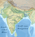
India Rivers (de).png 1,431 × 1,491; 3.01 MB
-
India rivers and lakes map-es.svg 1,650 × 1,860; 1.38 MB
-
India rivers and lakes map.svg 1,639 × 1,852; 462 KB
-
Indiarivers 2.png 350 × 402; 29 KB
-
Indiarivers.png 350 × 402; 89 KB
-
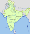
Indien Flüsse.PNG 350 × 402; 42 KB
-
Koch Bihar Sketch Map.jpg 563 × 611; 35 KB
-
Krishna Basin.png 1,272 × 896; 1.63 MB
-
Location Plan of projects in Narmada basin.jpg 2,998 × 1,218; 586 KB
-
Luni Riber Basin India.png 1,003 × 896; 877 KB
-
Mahanadi River basin.png 1,272 × 896; 1.69 MB
-
Major Rivers and Dam in India.jpg 1,024 × 1,284; 301 KB
-
Major Rivers in India.jpg 482 × 608; 52 KB
-
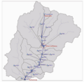
Hydrological-model-set-up-of-the-Mandakini-River.png 703 × 684; 296 KB
-
Map of south asian rivers.png 2,324 × 2,151; 740 KB
-
Map of Vedic India ru.png 683 × 489; 389 KB
-
Map of Vedic India.png 683 × 489; 424 KB
-
Narmada Basin.png 1,003 × 896; 1.06 MB
-
Narmadarivermap.jpg 1,600 × 822; 629 KB
-
PrincipaleRíosDeLaIndia.svg 1,650 × 1,860; 301 KB
-
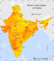
Rivers and lakes map.png 1,000 × 1,138; 91 KB
-
Rivers and lakes topo map.png 1,000 × 1,138; 99 KB
-
Rivers of India (Dutch).png 350 × 402; 40 KB
-
Sabarmati Mahi River Basin.png 1,272 × 896; 1.34 MB
-
Silhouette Map of Tawa Reservoir.png 744 × 608; 14 KB
-
Tapi River Basin.png 1,272 × 896; 1.62 MB


