Category:Maps of rivers of France
Jump to navigation
Jump to search
Subcategories
This category has the following 24 subcategories, out of 24 total.
- Maps of France with rivers (45 F)
*
A
B
- Maps of Bièvre River (27 F)
D
E
- Maps of Epte River (2 F)
G
L
M
- Maps of the Penfeld River (117 F)
R
S
- Maps of the Scheldt (25 F)
Media in category "Maps of rivers of France"
The following 187 files are in this category, out of 187 total.
-
Gouvernement général du Languedoc (Nicolas Sanson, 1651).jpg 6,656 × 5,120; 24.46 MB
-
Aa and connecting waterways-pcd.jpg 500 × 556; 86 KB
-
Aa and connecting waterways.jpg 500 × 556; 167 KB
-
Former stream bed of the Adour river (France).jpg 442 × 570; 32 KB
-
Aff OSM.png 461 × 600; 556 KB
-
Affluents de la rivière Ellé carte.jpg 2,062 × 2,398; 215 KB
-
AP-Régions-hydro.png 5,457 × 3,543; 1.49 MB
-
Arguenon cours d'eau.png 1,134 × 1,353; 1.72 MB
-
Arz (rivière) OSM.png 884 × 347; 626 KB
-
Aube river map.png 1,000 × 1,000; 391 KB
-
Aër cours d'eau.png 881 × 671; 343 KB
-
BarragesCarteCassini.jpg 1,024 × 645; 275 KB
-
Bassin de la Durance.png 890 × 633; 650 KB
-
Bassin versant de la Jamagne.jpg 2,100 × 1,700; 459 KB
-
Bassin-Creuse-Dep.jpg 3,507 × 2,480; 567 KB
-
Bassin-Creuse.jpg 3,507 × 2,480; 2.21 MB
-
Bassin-versant-Orgeval.jpg 1,831 × 1,279; 405 KB
-
Bassinversantnpdc.svg 3,489 × 2,329; 778 KB
-
Besançon location map.svg 877 × 986; 2.99 MB
-
Bonne (rivière).png 1,181 × 373; 660 KB
-
Brandifrout carte topo.png 867 × 696; 603 KB
-
BudS - Frankreich - Städte und Flüsse.jpg 9,583 × 9,336; 10.71 MB
-
Bélon cours d'eau.png 831 × 665; 339 KB
-
Panneau Calonne.JPG 2,560 × 1,920; 2.26 MB
-
1576 Ortellius ARTOIS.jpg 960 × 1,323; 1.07 MB
-
Canut de Renac OSM.png 387 × 559; 234 KB
-
Carte Eutie pi Brele Riviere-pcd.png 1,145 × 1,200; 1.16 MB
-
Carte France hydrographie cours d'eau fond bleu foncé.png 5,114 × 4,753; 11.02 MB
-
Cenischia location map.jpg 431 × 324; 96 KB
-
Coet Organ carte topo.png 896 × 775; 677 KB
-
Couesnon.png 790 × 835; 577 KB
-
Daoulas carte topo.png 1,114 × 876; 818 KB
-
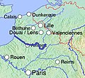
Deule.png 460 × 535; 6 KB
-
Doré cours d'eau.png 1,055 × 778; 356 KB
-
Douve.jpg 539 × 833; 60 KB
-
Douze river map OSM-fr.png 1,169 × 826; 1.39 MB
-
Ellez cours d'eau.png 1,116 × 821; 465 KB
-
Epte (rivière).png 329 × 420; 327 KB
-
Evel cours d'eau.png 1,247 × 676; 518 KB
-
Eyrieux.png 853 × 656; 794 KB
-
FR03-Bassins.png 5,457 × 3,547; 2.72 MB
-
FR07-Bassins.png 5,457 × 3,543; 2.51 MB
-
FR09-Bassins.png 5,457 × 3,543; 2.25 MB
-
FR11-Bassins.png 5,457 × 3,543; 2.51 MB
-
FR12-Bassins.png 5,457 × 3,547; 2.27 MB
-
FR15-Bassins.png 5,457 × 3,547; 2.26 MB
-
FR16-Bassins.png 5,457 × 3,547; 2.27 MB
-
FR17-Bassins.png 5,457 × 3,547; 2.26 MB
-
FR18-Bassins.png 5,457 × 3,547; 2.72 MB
-
FR19-Bassins.png 5,457 × 3,547; 2.26 MB
-
FR21-Bassins.png 5,457 × 3,547; 2.73 MB
-
FR22-Bassins.png 5,457 × 3,547; 2.6 MB
-
FR23-Bassins.png 5,457 × 3,547; 2.71 MB
-
FR24-Bassins.png 5,457 × 3,547; 2.27 MB
-
FR28-Bassins.png 5,457 × 3,547; 2.61 MB
-
FR29-Bassins.png 5,457 × 3,547; 2.7 MB
-
FR30-Bassins.png 5,457 × 3,543; 2.51 MB
-
FR31-Bassins.png 5,457 × 3,547; 2.27 MB
-
FR32-Bassins.png 5,457 × 3,543; 2.26 MB
-
FR33-Bassins.png 5,457 × 3,547; 2.26 MB
-
FR34-Bassins.png 5,457 × 3,543; 2.51 MB
-
FR35-Bassins.png 5,457 × 3,547; 2.61 MB
-
FR36-Bassins.png 5,457 × 3,547; 2.72 MB
-
FR37-Bassins.png 5,457 × 3,547; 2.71 MB
-
FR40-Bassins.png 5,457 × 3,543; 2.26 MB
-
FR42-Bassins.png 5,457 × 3,547; 2.8 MB
-
FR43-Bassins.png 5,457 × 3,547; 2.8 MB
-
FR44-Bassins.png 5,457 × 3,547; 2.71 MB
-
FR45-Bassins.png 5,457 × 3,547; 2.61 MB
-
FR46-Bassins.png 5,457 × 3,547; 2.26 MB
-
FR47-Bassins.png 5,457 × 3,547; 2.26 MB
-
FR48-Bassins.png 5,457 × 3,547; 2.26 MB
-
FR49-Bassins.png 5,457 × 3,547; 2.72 MB
-
FR53-Bassins.png 5,457 × 3,547; 2.61 MB
-
FR56-Bassins.png 5,457 × 3,547; 2.71 MB
-
FR58-Bassins.png 5,457 × 3,547; 2.74 MB
-
FR63-Bassins.png 5,457 × 3,547; 2.8 MB
-
FR64-Bassins.png 5,457 × 3,543; 2.25 MB
-
FR65-Bassins.png 5,457 × 3,543; 2.26 MB
-
FR66-Bassins.png 5,457 × 3,543; 2.5 MB
-
FR71-Bassins.png 5,457 × 3,547; 2.75 MB
-
FR72-Bassins.png 5,457 × 3,547; 2.61 MB
-
FR79-Bassins.png 5,457 × 3,547; 2.72 MB
-
FR81-Bassins.png 5,457 × 3,547; 2.26 MB
-
FR82-Bassins.png 5,457 × 3,543; 2.26 MB
-
FR84-Bassins.png 5,457 × 3,543; 2.51 MB
-
FR85-Bassins.png 5,457 × 3,547; 2.71 MB
-
FR86-Bassins.png 5,457 × 3,547; 2.72 MB
-
FR87-Bassins.png 5,457 × 3,547; 2.71 MB
-
France fluvial.png 2,000 × 1,898; 629 KB
-
France Rivers of Gers with 1977 inundation effects.svg 625 × 557; 964 KB
-
France Rivers of Gers.svg 625 × 557; 888 KB
-
France-Bassins-hydro.png 5,457 × 3,543; 1.54 MB
-
France-Régions-hydro.png 5,457 × 3,543; 1.97 MB
-
Gouessant cours d'eau.png 1,373 × 1,245; 1.78 MB
-
Gouët cours d'eau.png 1,208 × 837; 649 KB
-
Goyen cours d'eau.png 977 × 717; 264 KB
-
Haut Calavon, Riaille, Largue+loc.png 509 × 1,437; 1.17 MB
-
Hydrographie du Soissonnais.png 1,667 × 913; 2.67 MB
-
Hydrologie en Isère.svg 443 × 424; 3.04 MB
-
Hyères (rivière).png 592 × 595; 391 KB
-
Ic cours d'eau.png 924 × 717; 395 KB
-
Illet OSM.png 875 × 453; 402 KB
-
Inam cours d'eau.png 867 × 806; 397 KB
-
Isole cours d'eau.png 1,029 × 1,212; 1.25 MB
-
Jabron (Rhône).png 1,040 × 421; 546 KB
-
Karte der Moselstaustufen.png 1,480 × 2,689; 284 KB
-
Laita affluents.png 2,349 × 2,986; 2.11 MB
-
Laita carte.jpg 2,349 × 2,986; 607 KB
-
Langonnet cours d'eau.png 1,061 × 1,050; 786 KB
-
LB-Régions-hydro2.png 5,457 × 3,543; 3.16 MB
-
Le kergoat.png 1,920 × 1,080; 1.63 MB
-
Les Collières DE.png 3,000 × 1,469; 241 KB
-
Les Collières FR.png 3,000 × 1,469; 241 KB
-
Loc'h cours d'eau.png 1,186 × 1,141; 1.55 MB
-
Location Authie and Bresle River-fr.svg 1,145 × 1,200; 567 KB
-
Logne (affluent de la Boulogne).png 466 × 597; 370 KB
-
Loisance.png 890 × 436; 244 KB
-
Lorraine hydrologic map.svg 1,580 × 1,300; 264 KB
-
Lorraine Zorn.PNG 195 × 203; 18 KB
-
Luy de France river map OSM-fr.png 1,169 × 826; 1.39 MB
-
Léguer cours d'eau.png 1,481 × 1,411; 2.11 MB
-
MapAin1.jpg 121 × 149; 34 KB
-
MapAisne.jpg 269 × 154; 57 KB
-
MapMarne.jpg 260 × 206; 72 KB
-
MapSomme.jpg 184 × 169; 45 KB
-
Midou river map OSM-fr.png 1,169 × 826; 1.37 MB
-
Midouze river map OSM-fr.png 1,169 × 826; 975 KB
-
Minette (rivière).png 804 × 412; 209 KB
-
Moulin du Duc cours d'eau.png 1,134 × 1,112; 899 KB
-
Mès OSM.png 522 × 465; 173 KB
-
Méménil Vosges Hydrographie.svg 798 × 692; 80 KB
-
Naïc cours d'eau.png 1,416 × 879; 468 KB
-
MapOise.jpg 271 × 171; 63 KB
-
Orge (rivière).png 849 × 554; 936 KB
-
Pfaelzerwaldkarte Flussgebiete Blies.png 1,734 × 1,650; 4.89 MB
-
Pfaelzerwaldkarte Flussgebiete Eichel.png 929 × 788; 1.12 MB
-
Pfaelzerwaldkarte Flussgebiete Hauptwasserscheiden.png 2,905 × 3,417; 14.79 MB
-
Pfaelzerwaldkarte Flussgebiete Hornbach.png 900 × 888; 1.38 MB
-
Pfaelzerwaldkarte Flussgebiete Isch.png 750 × 637; 722 KB
-
Pfaelzerwaldkarte Flussgebiete Moder.png 2,284 × 1,537; 5.04 MB
-
Pfaelzerwaldkarte Flussgebiete Sauer.png 1,492 × 1,110; 2.23 MB
-
Pfaelzerwaldkarte Flussgebiete Schwarzbach.png 1,290 × 1,406; 3.16 MB
-
Pfaelzerwaldkarte Flussgebiete Wieslauter.png 1,490 × 1,162; 2.65 MB
-
Pfaelzerwaldkarte Flussgebiete Zorn.png 2,082 × 1,027; 2.86 MB
-
Pfaelzerwaldkarte Flussgebiete.png 2,905 × 3,417; 14.74 MB
-
Piccola Dora location map.png 766 × 591; 556 KB
-
Planbiberonneetbeuvronne.png 295 × 260; 50 KB
-
Planclery.png 328 × 244; 63 KB
-
Planclery1.png 328 × 244; 64 KB
-
Planloing.png 592 × 753; 325 KB
-
Poulancre carte topo.png 1,271 × 896; 1.59 MB
-
Pyrenees relief map with rivers-fr.svg 3,200 × 1,900; 2.41 MB
-
Raille - Oron.png 2,257 × 801; 99 KB
-
Rance cours d'eau.png 880 × 723; 495 KB
-
Rance.map.wmt.png 697 × 698; 597 KB
-
Rio san luigi mappa.png 851 × 637; 556 KB
-
River Aa location.jpg 480 × 489; 94 KB
-
River Scarpe waterway location.jpg 1,000 × 639; 81 KB
-
Rivers and Lakes of France.png 5,000 × 4,500; 12.15 MB
-
Rivière Aulne carte.png 4,488 × 2,680; 1.3 MB
-
Rivière Aven carte.png 2,484 × 3,496; 1.44 MB
-
Rivière Aven.jpg 2,484 × 3,496; 561 KB
-
Rivière de Penzé - btv1b53015003k.jpg 8,981 × 7,755; 9.2 MB
-
Rivière la Maine Vendée.png 1,654 × 1,654; 297 KB
-
Rivière Scorff carte.png 3,333 × 5,588; 2.86 MB
-
Rivières Lannemezan.JPG 508 × 521; 42 KB
-
RM-Régions-hydro.png 5,457 × 3,543; 2.06 MB
-
RMC-Régions-hydro.png 5,457 × 3,543; 2.78 MB
-
Ruisseau de Kerustang cours d'eau.png 767 × 623; 284 KB
-
Ruisseau de Palet OSM.png 363 × 460; 166 KB
-
Réseau de drainage actuel.jpg 680 × 906; 178 KB
-
RíosNoresteDeFranciaYBélgica.svg 1,086 × 955; 434 KB
-
Sarre cours d'eau.png 876 × 895; 460 KB
-
Sarthe river.jpg 700 × 619; 104 KB
-
Scorff03.jpg 3,333 × 5,588; 1.46 MB
-
Semnon OSM.png 952 × 370; 408 KB
-
SN-Régions-hydro.png 5,457 × 3,543; 3.1 MB
-
Stang Hingant cours d'eau.png 1,209 × 887; 385 KB
-
Sulon carte topo.png 761 × 761; 587 KB
-
Topographic map of Garonne and Adour.svg 642 × 627; 2.9 MB
-
Topographic map of South-West France with main rivers and cities.svg 1,028 × 885; 2.9 MB
-
Tracé de la Loue.jpg 917 × 996; 218 KB
-
Trieux cours d'eau.png 788 × 658; 347 KB
-
Wa-mape corantès aiwes do Marok al Walonreye.jpg 1,496 × 2,256; 500 KB
-
Yar (cours d'eau breton).png 353 × 621; 141 KB


