Category:Maps of rivers of Doubs (department)
Jump to navigation
Jump to search
Subcategories
This category has the following 2 subcategories, out of 2 total.
M
Media in category "Maps of rivers of Doubs (department)"
The following 12 files are in this category, out of 12 total.
-
25-Cours eau 50km.jpg 3,507 × 2,480; 575 KB
-
25-Cours eau.jpg 3,507 × 2,480; 929 KB
-
Allaine.png 800 × 459; 741 KB
-
Barbèche OSM 01.png 1,433 × 806; 798 KB
-
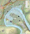
Besançon 1910 flood map.svg 877 × 986; 1.67 MB
-
Clauge 2.png 631 × 346; 334 KB
-
Clauge.png 673 × 315; 326 KB
-
Cusancin OSM.png 1,702 × 918; 3 MB
-
Dessoubre.png 453 × 474; 389 KB
-
Drugeon.png 460 × 460; 356 KB
-
Reverotte OSM.png 1,468 × 644; 1.63 MB
-
Ruisseau de Buhin OSM.png 1,880 × 1,214; 3.76 MB


