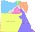
Category:Maps of regions of Egypt
Jump to navigation
Jump to search
Countries of Africa: Burkina Faso · Cameroon · Chad · Djibouti · Egypt‡ · Equatorial Guinea · Ethiopia · Guinea · Ivory Coast · Libya · Madagascar · Malawi · Mali · Mauritania · Morocco · Namibia · Niger · Senegal · Somalia · South Sudan · Sudan · Tanzania · Togo · Uganda
Limited recognition: Ambazonia · Somaliland
‡: partly located in Africa
Limited recognition: Ambazonia · Somaliland
‡: partly located in Africa
العربية: أقاليم مصر
Media in category "Maps of regions of Egypt"
The following 16 files are in this category, out of 16 total.
-
Map of Alexandria Economic Region, Egypt.jpg 1,024 × 725; 215 KB
-
Map of Asssuit Economic Region, Egypt.jpg 1,024 × 725; 205 KB
-
Map of Delta economic region, Egypt.jpg 848 × 600; 204 KB
-
Map of North Upper Egypt economic region.jpg 980 × 762; 245 KB
-
Map of South Upper Egypt economic region.jpg 1,024 × 806; 303 KB
-
Map of Suez economic region, Egypt.jpg 1,000 × 708; 270 KB
-
أقاليم مصر.png 837 × 743; 15 KB
-
أقاليم مصر2.png 837 × 743; 12 KB
-
أقاليم مصر3.png 837 × 743; 53 KB
-
إقليم الإسكندرية.PNG 837 × 743; 28 KB
-
إقليم الدلتا.PNG 837 × 743; 28 KB
-
إقليم القاهرة الكبرى.PNG 837 × 743; 27 KB
-
إقليم القناة.PNG 837 × 743; 18 KB
-
إقليم جنوب الصعيد.PNG 837 × 743; 18 KB
-
إقليم شمال الصعيد.PNG 837 × 743; 28 KB
-
إقليم وسط الصعيد.PNG 837 × 743; 28 KB


