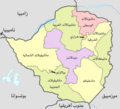
Category:Maps of provinces of Zimbabwe
Jump to navigation
Jump to search
Subcategories
This category has the following 11 subcategories, out of 11 total.
B
- Maps of Bulawayo (7 F)
H
- Maps of Harare (7 F)
M
- Maps of Mashonaland East (7 F)
- Maps of Mashonaland West (7 F)
Media in category "Maps of provinces of Zimbabwe"
The following 8 files are in this category, out of 8 total.
-
Provinces of Zimbabwe.svg 630 × 490; 33 KB
-
Zim-provinces blank.jpg 250 × 228; 7 KB
-
Zimbabwe Base Map.png 1,117 × 708; 353 KB
-
Zimbabwe Provinces (adm) numbered 300px.png 300 × 233; 25 KB
-
Zimbabwe Provinces (adm) numbered 300px.svg 672 × 523; 36 KB
-
Zimbabwe Provinces numbered 300px.png 300 × 275; 27 KB
-
Zimbabwe.geohive.gif 620 × 537; 37 KB
-
مقاطعات زيمبابوي.png 2,000 × 1,815; 322 KB


